
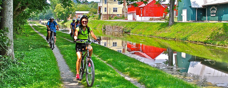
At first glance, it may seem overwhelming to choose where to begin your adventure on the C&O Canal. There are over 80 access points to the canal with ample parking. Begin your day trip adventures on the canal by checking out these suggested points of interest below!
Continue reading or view by region: East | Central | West
You can also copy this itinerary into our C&O Canal Itinerary Builder here.
East: DC to Brunswick
Mile Marker 0.0 – Georgetown.
The C&O Canal begins in Georgetown, and there are many ways to access the canal in this area. Canal users can explore Locks 1, 2, 3, and 4, a picturesque series of four locks very close together, separated by boat basins. A bust of Supreme Court Justice William O. Douglas is placed at Lock 3, in honor of Douglas, who helped raise awareness of a 1950s plan to turn the canal into a parkway. Tucked along M Street in Georgetown, just east of the towpath, is the Old Stone House. It is the oldest structure on its original foundation in the nation’s capital. The Abner Cloud House is one of the oldest existing structures on the canal. Here, The Colonial Dames of America, Chapter III, offer interpretive programs. Continuing upstream from Georgetown, canal users can see Fletchers Cove and Carderock Recreation Area, which is the Park’s premiere rock climbing area.
Mile Marker 3.2 – Fletchers Cove
A large parking lot off of Canal Road NW, near Fletchers Boathouse and the Abner Cloud House makes for easy access to the Canal at Fletchers Cove. The area is popular for fishing and boating, biking, hiking, and picnicking. You can rent rowboats, kayaks, canoes, and bikes at the concession stand or grab a hot dog and snacks. The slow waters make it an ideal location for fishing and bird watching. The Capital Crescent Trail crosses and parallels the towpath at Fletchers Cove. Built upon the abandoned rail bed of the 11-mile Georgetown Branch of the B&O Railroad, the trail is one of the most popular of more than 700 rails-to-trails projects nationwide. Downstream, canal users will find the Abner Cloud House and Georgetown. Heading upstream, canal users will find Lockhouse 6, part of the Canal Quarters program, the Cabin John Bridge, a National Historic Civil War Landmark, Seven Locks, Lockhouse 10, also part of the Canal Quarters program, and Carderock Recreation Area, the Park’s premiere rock climbing area.
Mile Marker 10.8 – Carderock
Carderock is accessible from the Clara Barton Parkway with lots of parking. It’s a great location for those who enjoy outdoor recreation and picnicking. The western end of Carderock is the Park’s premiere rock climbing area, with routes ranging from easy to extremely technical. Billy Goat Trail C surrounds the entire area and offers a beautiful 1.6-mile hike along the Potomac River. Canal users traveling downstream will find Lockhouse 10, part of the Canal Quarters program where guests can spend the night living as the lock keepers once did, Seven Locks, the Cabin John Bridge, a National Historic Civil War Landmark, Lockhouse 6, also part of the Canal Quarters program, Fletchers Cove, the Abner Cloud House, and Georgetown. Upstream, canal users will come to Great Falls, where the historic Great Falls Tavern serves as a visitor center, and Lockhouse 22,
Mile Marker 22.7 – Riley’s Lock and Seneca Aqueduct
Riley’s Lock offers lots of parking for easy access to this section of the C&O Canal. Riley’s Lockhouse is well restored and local Girl Scouts dressed in period clothing provide interpretation and guide visitors here on Saturdays during the spring and fall. This is also the location of an engineering marvel on the canal. Of the canal’s 11 aqueducts and 74 lift locks, this is the only one that was both a lift lock and an aqueduct. Canal users heading downstream will find Lockhouse 22, part of the Canal Quarters program, and Great Falls, where the historic Great Falls Tavern serves as a visitor center. Upstream, canal users will find the remains of Goose Creek River Lock, Edwards Ferry and Lockhouse 25, another lockhouse in the Canal Quarters program.
Rileys Lock. Photo Credit: John Gensor
Mile Marker 35.5 – Whites Ferry
Whites Ferry is the last of 100 ferries that operated on the Potomac River, transporting automobiles, cyclists, and pedestrians across the river from Montgomery County, Md., to Loudoun County, Va. This canal access point offers ample parking for access to the ferry, the canal, the boat ramp, and Whites Ferry Store. Canal users heading downstream will find access to Edwards Ferry, Lock 25 and Lockhouse 25, part of the Canal Quarters program. Canal users heading upstream from Whites Ferry will find the Monocacy Aqueduct, and Nolands Ferry.
Mile Marker 48.2 – Point of Rocks
Point of Rocks has been a longtime transportation crossroads, beginning with the Native Americans, then European traders and settlers, until the arrival of the railroad led to rapid growth. During the heyday of the canal, the town was booming with businesses, hotels, restaurants, and more! The canal terminated operations in 1924, leading to the decline of Point of Rocks. The original village is a county park and a parking lot for railroad commuters, however there is a deli, convenience and gas station store, restaurant, library, church, and the picturesque Point of Rocks Train Station. Downstream, canal users can travel to Nolands Ferry, one of the earliest crossings on the Potomac during Native American times, and the Monocacy Aqueduct. Heading upstream, canal users will find Lander, with access to the Catoctin Aqueduct, and Brunswick.
Mile Marker 55.0 – Brunswick
Brunswick was a small community of several hundred people when the C&O Canal reached the area. When the B&O RR established a major railyard there, the town grew dramatically, becoming very much a “company town.” Today Brunswick is on the MARC commuter train line to Washington, D.C. Brunswick’s downtown has restaurants, specialty shops, and antiques stores as well as the C&O Canal Visitor Center and the Brunswick Heritage Museum. Downstream, canal users can visit Lander, with access to the Catoctin Aqueduct, Point of Rocks, and Nolands Ferry, one of the most ancient crossings of the Potomac. Upstream, canal users can access Weverton, Harpers Ferry and Dargan Bend Recreation Area.
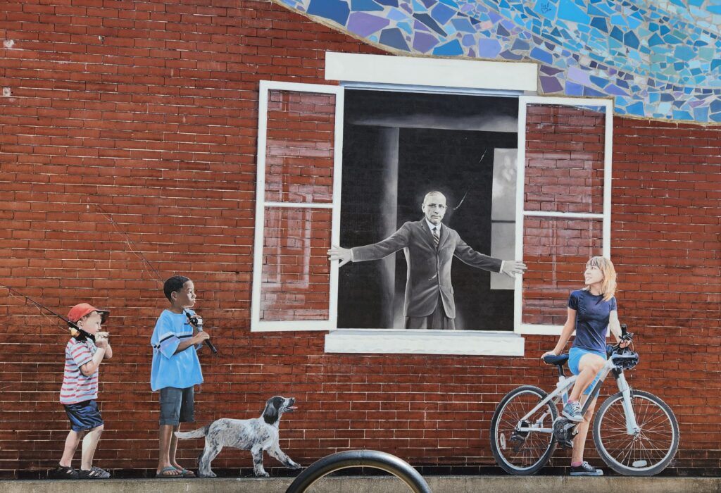
Mural in Brunswick, MD. Photo by Kelly Hilton
Central: Brunswick to Hancock
Mile Marker 60.7 – Harpers Ferry National Historical Park
The town of Harpers Ferry is located at the confluence of the Potomac and the Shenandoah Rivers and is rich in history. It was designated a National Monument in 1944, and later a National Historical Park in 1953. Harpers Ferry is an ideal day trip with all the things to see and do at the park, which covers a multitude of interpretive themes from the Industrial Revolution to the Lewis and Clark Expedition to the Civil War and Civil Rights Movement. From Harpers Ferry, canal users can travel downstream on the Appalachian Trail where it uses the towpath for three miles to Weverton, as well as Brunswick, and Lander, with access to the Catoctin Aqueduct. Upstream from Harpers Ferry, canal users can see a dry dock at Lock 35, Dargan Bend Recreation Area, the lime kiln ruins at Antietam Ironworks, and Antietam Aqueduct.
Mile Marker 72.8 – Railroad Bridge/Canal Road
The Railroad Bridge/Canal Road lot provides ample parking and access to some well-known locations along this stretch of canal. The remains of Lock 38, also known as the Shepherdstown River Lock, are located here. It is one of only three river locks on the canal and was used most often by Boteler’s Mill, shipping and receiving cement and coal materials via canal boat. Downstream, canal users will find Antietam Aqueduct, the ruins of Antietam Ironworks, and Dargan Bend Recreation Area. Upstream, canal users can see Ferry Hill Plantation, the Killiansburg Cave and Snyders Landing.
Mile Marker 84.0 – Big Slackwater
The Big Slackwater section of the C&O Canal is a modern-day engineering marvel. The reconstruction of a 2.7-mile section of towpath here had been closed for more than a decade due to flood damage. It reopened in 2012 and features a suspended, 10-foot-wide concrete walkway, anchored in the stone of the cliff embankment. Downstream, canal users can enjoy the impressive roaring power of Dam 4. There are lots of cave features along this section of the canal including Bergen Cave at Dam 4, Snyders Landing, and the Killiansburg Cave, which is where a group of Sharpsburg residents took shelter during the Battle of Antietam. Upstream, canal users can enjoy McMahon’s Mill area, which has more cave features. The towpath then becomes quiet as it leads into the 10-mile stretch with no access points.
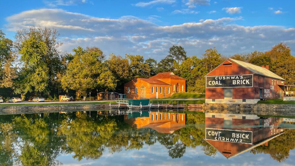
Williamsport Cushwa Basin. Photo by Beth Sherwood
Mile Marker 99.8 – Williamsport/Cushwa
Williamsport is a bustling hub of activity on the C&O Canal. It is the only place in North America where visitors can see a lift lock and refurbished lockhouse, a railroad lift bridge, a canal turning basin and a re-watered aqueduct with seasonal boat rides available. Lock 44 is furnished and is open to the public seasonally and canal boat rides are offered from Cushwa Basin over the re-watered aqueduct. Downstream, canal users can enjoy a quiet 10-mile stretch of the canal with no access points. This section follows close to the river and is exceptional for wildlife viewing opportunities and wildflowers in the spring. A historical marker at Falling Waters explains the area’s significance during the Confederate Retreat from Gettysburg in 1863. Upstream, canal users can see Dam 5 and Four Locks, including Lockhouse 49, part of the Canal Quarters program, where guests can spend the night in a lockhouse.
Mile Marker 108.0 – Four Locks
Four Locks (Locks 47, 48, 49, and 50) was a thriving community when the canal was operational. Today, several of the historic buildings remain, including Lockhouse 49, also a part of the Canal Quarters program. The area is now popular for recreation, from fishing and boating to bicycling and hiking. Downstream, canal users can access Dam 5 and Williamsport/Cushwa Basin. Williamsport is the only place in North America where visitors can see a lift lock and refurbished lockhouse, a railroad lift bridge, a canal turning basin and a re-watered aqueduct with seasonal boat rides available. Upstream, canal users can enjoy McCoys Ferry, with its Civil War history and beautiful views, as well as Fort Frederick State Park, which offers both historical interpretation and opportunities to enjoy nature, Big Pool, a popular fishing and boating site, and Licking Creek Aqueduct.
Four Locks near Clear Springs, Maryland. Photo by Nicholas Clements
West: Hancock to Cumberland
Mile Marker 124.1 –Hancock Visitor Center Parking
Downstream, canal users can view Licking Creek Aqueduct, Big Pool, which is a popular fishing and boating site, and Fort Frederick State Park, which borders the canal. Upstream, canal users can enjoy Little Tonoloway Recreation Area, with beautiful picnic views of the Potomac River, and Tonoloway Aqueduct
Mile Marker 136.0 – Western MD Rail Trail
The Western Maryland Rail Trail (WMRT) runs parallel to the C&O Canal from Big Pool to Little Orleans. This parking lot at Pearre allows for easy access to the WMRT, and canal users can connect to the towpath less than a mile away at Lock 56. Downstream from here, many locals bike what they call the “bow-tie,” which utilizes both the WMRT and the towpath for 40+ miles round-trip. Bikers can experience the history and terrain of both the towpath and the restored railroad bed. Upstream, canoe rentals are available at Little Orleans Grocery Store/Bill’s Place by the Fifteenmile Creek Drive-In Campground. This is the canoe and float take-out point for the 21-mile trip through the Paw Paw Bends. The Fifteenmile Creek Aqueduct is also accessible from the campground. The rail trail now continues westward to Little Orleans, which includes the Indigo Tunnel Bypass, which utilizes ramps to the canal.
Mile Marker 184.5 – Cumberland
This terminus of the C&O Canal offers easy access to the C&O Canal Visitors Museum, housed in the historic 1913 Western Maryland Railway Station. The museum offers interactive exhibits and educational displays. Cumberland is where the terminus meets up with the B&O Railroad and the National Road. It’s also where the canal connected to the Great Allegheny Passage (GAP) trail which continues on to Pittsburgh. Downstream from Cumberland you can access the smallest and the last of the aqueducts along the canal, Evitts Creek Aqueduct, and the last lift lock on the canal, Lock 75. There are wonderful bird watching opportunities on this section of the canal, particularly at mile marker 176.87 where a marsh that was formerly a basin attracts marsh birds and other wildlife. Similar wildlife can be viewed at mile marker 180.35 where the berm is a marsh.
Written by: Charissa Hipp