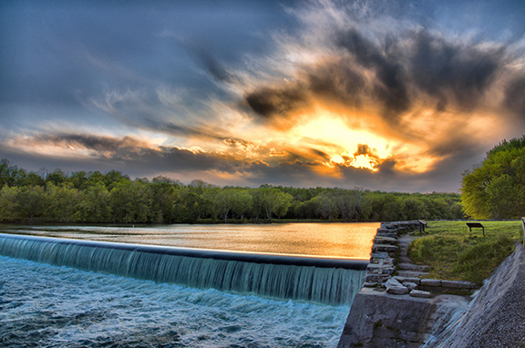
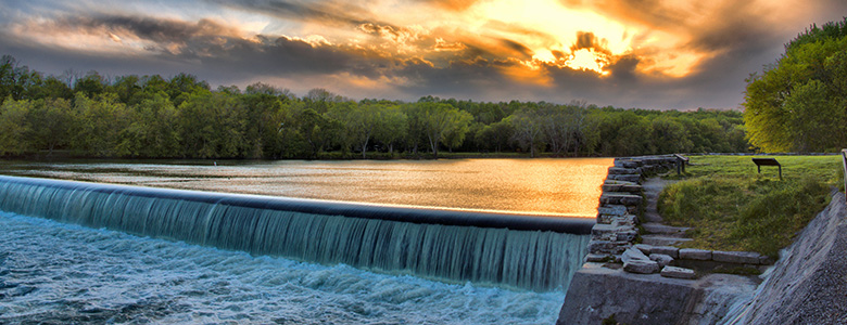
‘Sky Fire’ at Dam 5 by Margaret J Clingan
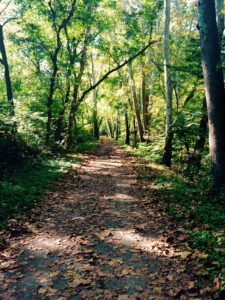
The C&O Canal National Historical Park is 184.5 miles long — that’s a lot of ground to cover! This itinerary will help you hit the highlights. Explore, learn the history of the canal, enjoy the stories our Park Rangers most love to share, and deepen your appreciation and understanding of one of America’s great historical parks.
You can also copy this itinerary into our C&O Canal Itinerary Builder here.
East: DC to Brunswick
Mile Marker 0.0 Tide Lock
The Georgetown Tide Lock is the zero milestone terminus on the C&O Canal, and all measurements on the canal were calculated from this point; however, the construction of the canal did not begin here.
Mile Marker 0.4 Douglas Bust
Supreme Court Justice William O. Douglas played an integral part in saving the canal from being turned into a parkway during the 1950s. His love for the canal led him to challenge editors from The Washington Post to hike the entire 184.5 miles of towpath with him to see why the space should be left untouched. His efforts provided a focal point for media attention and intensified the efforts of conservation groups who sought to preserve the canal. Thanks to his efforts, the National Park Service abandoned the parkway idea.
Mile Marker 1.0 Alexandria Aqueduct
An earlier attempt to relieve the congestion of canal boats unloading cargo in Georgetown, the Potomac Aqueduct allowed canal boats to cross over the Potomac River, connect with the Alexandria Canal, and deliver goods to the wharves at Alexandria, Virginia. This structure was built between 1833 and 1843. Only two of the aqueduct’s abutments and one pier near the Virginia shore remain today.
Mile Marker 2.3 Incline Plane
The Incline Plane was built in 1876 as a way to combat early traffic issues during the heyday of the canal. It lowered boats directly into the Potomac River to avoid boat traffic in Georgetown and delays there. Prior to that, some frustrated boat captains were having to wait two days to get into Georgetown from two miles away because of boat traffic. Since Georgetown was not the final destination for every boat and many just needed to go through Georgetown to access the Potomac River at the tide lock, the incline plane was created to enable boats to bypass Georgetown. A river lock wouldn’t work because the location where the backup occurred was more than 39 feet above the river at low tide. The Potomac Lock and Dock Company proposed the incline plane, which was a caisson into which a boat would float. The boat, encased in the caisson, traveled on the rails of the incline plane from the canal and descended into the river. It was balanced by two counterweights and powered by a turbine supplied with waterpower from the canal. This engineering marvel was the largest of its kind in the world. Unfortunately, it soon became non-essential as transportation on the canal dramatically declined in the following decade. The incline plane was seriously damaged during a flood in 1889 and was never put back into service. Today you can barely make out the incline straight up from the wayside exhibit along the canal.
Mile Marker 3.1 Abner Cloud House and Mill
One of the oldest existing structures on the Canal, the Abner Cloud House dates back to 1801. The site provided grain and excellent quality flour called “Evermay” to Washington, D.C. for nearly 70 years. Only ruins of the mill remain, but the house was restored in the 1970s. Today, the Colonial Dames of America, Chapter III, periodically offers interpretive programs in the house.


Mile Marker 5.4 Lock 6
When you happen upon the lockhouse nestled beside Lock 6, you wouldn’t know that this quaint house along the canal had witnessed so much history. Learn about its past and experience life on the canal with an overnight stay at Lockhouse 6, part of the Canal Quarters program. Lockhouse 6 is furnished in the 1950s time period and tells the story of Supreme Court Justice William O. Douglas’s walk of the entire 184.5-mile long towpath to help save the canal. Learn how you can spend the night in this lockhouse here.
Mile Marker 8.8 Lock 10
Many canal stories involve the canal’s continuous reinvention of itself. The area surrounding Lock 10 was brought back to life after multiple floods by two African American Civilian Conservation Corps camps. Lockhouse 10, a part of the Canal Quarters program, tells their story. Like Lockhouse 6, it provides a unique lodging option for your canal visit. It is furnished in the 1930s time period and tells the story of the Civilian Conservation Corps (CCC) efforts to preserve the canal. With a screened-in porch overlooking the canal and full amenities, this lockhouse provides a restful spot to recharge from your canal explorations. Learn how you can spend the night in this lockhouse here.
Mile Marker 12.2 Anglers
Located between Billy Goat Trail Sections A and B and just downstream from Widewater is Anglers, one of the most visited sections of the C&O Canal. The natural beauty of Anglers provides the perfect backdrop for walkers, hikers, bikers, kayakers, birders, fishermen, photographers, and painters alike. However, to Canal engineers, Anglers posed a problem: rock. Learn how they have wrestled with the rocky area for over a century. Anglers is now a popular fishing spot.
Mile Marker 12.4 Mather Gorge
Mather Gorge is part of the Potomac Gorge and lies just downstream from Great Falls. Its sheer cliffs provide a mini-canyon for the wild Potomac River. It is a great place to watch the water bounce off the rocks and for sunrises.
Mile Marker 12.9 Widewater
Located between Great Falls and Anglers, Widewater has a natural wildness to it. It is easy to forget that it is man-made. Although it looks more like a lake, Widewater is part of the Potomac River’s historic path. Canal engineers decided to use this river bed as part of the canal to save on the effort of carving through more rock. Most of the canal is only six feet deep and 60 feet wide, but not Widewater. In some places it is around 50 feet deep and almost 500 feet across. On most days, it is quiet and serene. It is a great place to view the sunrise, bird watch, fish or take a flatwater kayaking trip.
Mile Marker 13.8 Stop Gate
Stop gates were constructed along the C&O Canal to protect the canal, its structures, and communities built around the canal from flood waters. This stop gate was originally built in 1852 and reconstructed with a modern winch system by the National Park Service in 2009. Located not far from the Great Falls Visitor Center, the top portion of the stop gate resembles a covered bridge but it’s actually a winch house. It stores a winch and planks of wood, just a little wider than the foundation. When the river floods, the stop gate is deployed to create a temporary dam that protects the canal downstream. The winch is used to lower the planks, one at a time, through the floor and into grooves that have been cut into both sides of the stone foundation. Some water does pass through, but the majority is stopped from rushing downstream into the canal and causing damage. The use of seven stop gates reduced flood damage and prevented additional devastation throughout the canal’s history.


Mile Marker 14.4 Great Falls Area
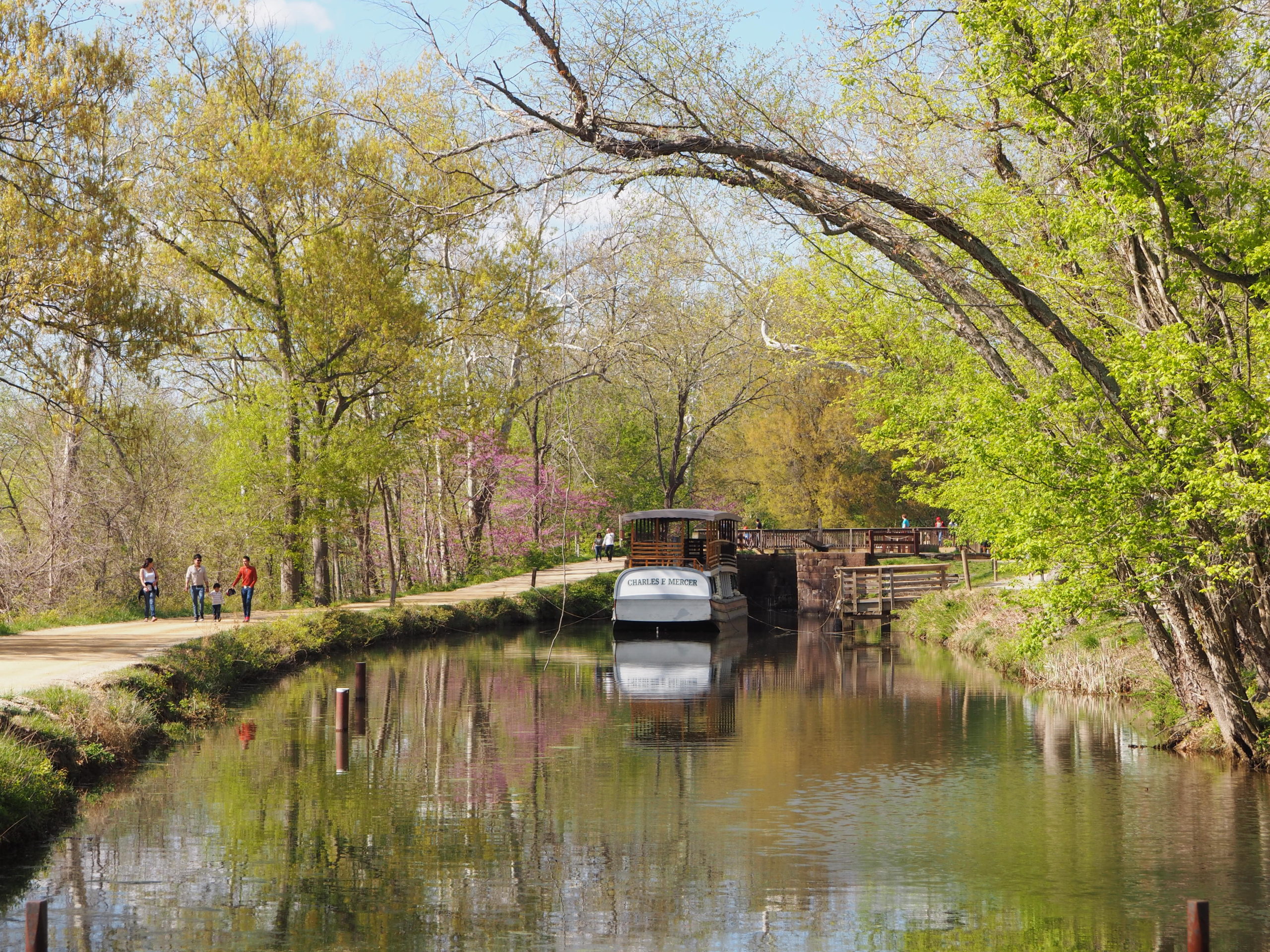
The Great Falls Area is one of the most popular sections of the C&O Canal National Historical Park, with the Historic Great Falls Tavern as its centerpiece. Once known as the Crommelin House, today, the tavern is a visitor center for the Park, offering visitor services, exhibits, interpretive programs, and more. This grand two-story historic structure, completed in 1829, served a number of purposes through the years as a locktender’s house, a tavern, a hotel, and even a private club. You will also find hiking trails and a canal boat ride (see below) at Great Fall, as well as scenic overlooks with dramatic views of the Potomac River thundering over the rocks.
Mile Marker 14.4 Charles F. Mercer Canal Boat
One of the most authentic experiences available on the C&O Canal is a canal boat ride. Experience life in the 1870s, a history lesson and a unique boat ride that includes a ride through a 19th century lock, complete with canal mules and costumed guides. You’ll get all this and more during an hour-long ride aboard the replica Charles F. Mercer canal boat at the Historic Great Falls Tavern. (Check www.nps.gov/choh for the schedule of boat rides. Rides are closed for 2020 and will resume in 2021.)
Mile Marker 14.4 Gold Mine Trails
During the Civil War, a Union soldier was stationed along the Maryland side of the Potomac River near Great Falls. While cleaning up in a creek, he noticed a glint of gold. After the war, he returned to the area, bought some farm land, and started mining for gold in Montgomery County. Eventually, 30 small mines were opened. One of the largest was the Maryland Mine. Today, a loop trail starting at the Great Falls Tavern Visitors Center will take you up past the mine ruins.
Mile Marker 16.7 Lock 21 Swains
The history of Lock 21 and the Swain family will forever be intertwined. Swain family members can be traced back to the original construction of the Canal, and their tradition of service at this lock house extended through the Canal’s most thriving decades and much of the 20th century. Also a part of the Canal Quarters program, Lockhouse 21 is also known as “Swains Lockhouse” after the family. This lockhouse interprets 1916, the year the National Park Service was formed and the date when the C&O Canal was beginning to transition from a working canal to a recreational space. The lockhouse has been completely modernized with full amenities, including an ADA-accessible bathroom and a Murphy bed on the first floor, ramps into the house, and hallways wide enough to accommodate a wheelchair. Learn how you can spend the night in this lockhouse here.


Mile Marker 16.7 Lock 22 Pennyfield
Located at mile 19.63 on the C&O Canal, Pennyfield Lockhouse at lock number 22 is a quiet place of escape for those seeking from the hectic pace of life in Washington, D.C. In the 1870s, then-President Grover Cleveland would regularly visit Pennyfield in order to pursue his favorite hobby of fishing. You can experience life on the canal with an overnight stay at Lockhouse 22, part of the Canal Quarters program. Lockhouse 22 is furnished in the 1830s time period, reflecting on the early phase of canal construction and the architectural marvels that were necessary to make it functional. Step back in time and experience life as the lock keepers truly lived. Learn how you can spend the night in this lockhouse here.
Mile Marker 22.7 Lock 24 Rileys Lockhouse and Seneca Aqueduct
Seneca Aqueduct and Lock 24 are combined into a single structure here, the only place along the canal that this was necessary. This is one of 11 aqueducts that carried the canal over major tributaries of the Potomac.
Riley’s Lockhouse is very well restored, with one-and-a-half stories over a full basement. Local Girl Scouts dressed in period clothing periodically provide interpretation and guide visitors through the historic home.
Mile Marker 22.8 Seneca Stone Cutting Mill
Seneca Stone Cutting Mill operated from 1837 to the early 1900s, milling stone from Seneca Quarry for many structures on the canal and public buildings in Washington, D.C., including the iconic Smithsonian Castle on the National Mall. The mill’s water wheel, and later a turbine, were powered by water from the canal. Seneca Stone Cutting Mill also cut granite and stone shipped from neighboring quarries. Granite and marble used in the U.S. Capitol and the Washington Monument were cut here.
Mile Marker 30.9 Lock 25 Edwards Ferry
Activity at Edward’s Ferry began very early in the Civil War with a Union encampment and commissary established here. The area continued to be used by both Union and Confederate troops throughout the war. Today, you can experience life on the Canal with an overnight stay at Lockhouse 25, part of the Canal Quarters program. Lockhouse 25 is nestled in the sleepy town of Edwards Ferry and is furnished in the 1860s time period, telling the story of the Civil War’s impact on the Canal. Learn how you can spend the night in this lockhouse here.
Mile Marker 30.9 Ruin of Jarboe’s Store
Close to Lock 25 are the brick ruins of Jarboe’s store. During the late 19th century and early 20th century, Eugene E. Jarboe ran a grocery and feed store, while also serving as postmaster at Edward’s Ferry. Gene’s sons, Sam and John, ran the store after their father tragically drowned in the lock while loading cattle. The store closed in 1906, and the NPS re-stabilized the ruins from 2008-2010.


Mile Marker 35.5 White’s Ferry
White’s Ferry is a one-of-a-kind on the Potomac River. Until it closed in 2020, it was the last operating ferry on the river, transporting vehicles, cyclists and pedestrians from Maryland across to the Leesburg area of Virginia. The ferry dates back to the early 1800s and gets its name from former Confederate Lieutenant Colonel Elijah White, who owned a nearby farm and purchased the ferry after the Civil War.
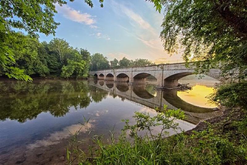
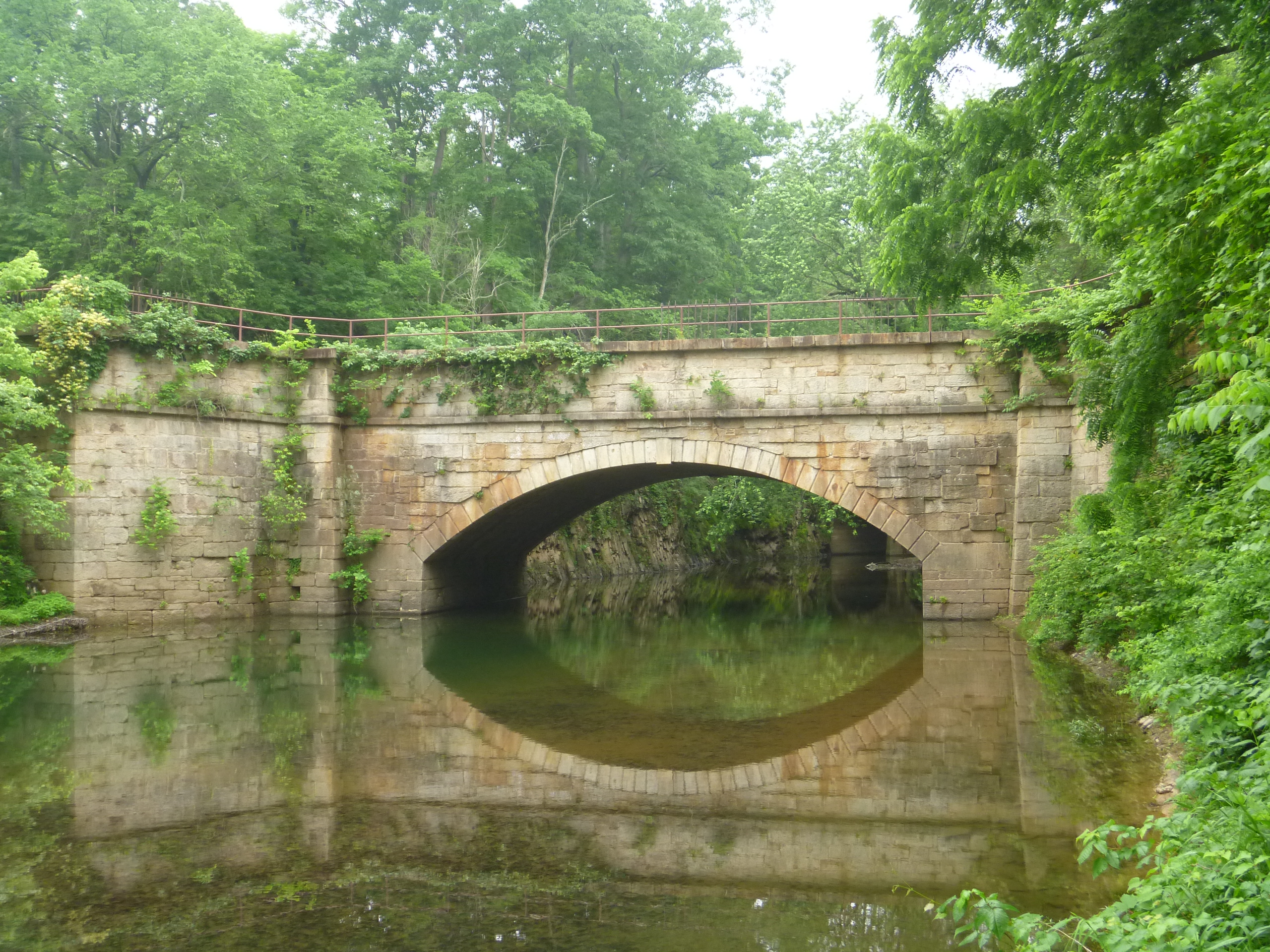
Mile Marker 42.2 Monocacy Aqueduct
The Monocacy Aqueduct is the largest of the canal’s 11 stone aqueducts. It is often considered one of the two finest features of the C&O Canal. It was built from 1829-1833.
Mile Marker 49.0 Lock 28
Lockhouse 28 is the most remote of all the Canal Quarters lockhouses, located nearly a half mile from the nearest parking. This rustic retreat was completed in 1837 and is a reminder of the fierce competitive race between the Chesapeake & Ohio Canal and the Baltimore & Ohio Railroad in the race to reach the Ohio River Valley. Learn how you can spend the night in this lockhouse here.
Mile Marker 51.5 Catoctin Aqueduct
The Catoctin Aqueduct is listed on the National Register of Historic Places. It was built with two semi-circle arches on either side of an elliptical arch. The elliptical arch was not structurally strong and began to sag, leading to structural failure. In 1973 two arches collapsed leaving only a remnant of the eastern arch standing. The Park Service buried the original stones to help preserve them in case the aqueduct was ever restored, which began in 2007. The restored aqueduct was dedicated and re-opened in 2011.


Central: Brunswick to Hancock
Mile Marker 62.5 Fort Duncan
The construction of Fort Duncan began in October 1862, shortly after the Battle of Antietam and the surrender of Harpers Ferry to Confederate forces. The mission of the fort was to guard the land surrounding Harpers Ferry and Bolivar Heights, as well as traffic on the Baltimore and Ohio Railroad and Chesapeake and Ohio Canal. Located across from Bolivar Heights, Fort Duncan is the far left flank of the Bernard Line, a series of fortifications along Maryland Heights. Ever vigilant, the only action Fort Duncan saw was a small demonstration following Jubal Early’s raid on Washington in 1864.
Mile Marker 65.2 Shinhan Limestone Kilns
At this point along the Canal, you can observe brick-lined arches in a concrete facing. These are the remains of several limestone kilns that were used to create fertilizer, plaster and cement during the 19th century. Owned by O.J. Shinhan, the kilns were operating as late as the 1960s. Cement was likely not produced here after the turn of the century, however, as Portland cement became the preferred product.
Mile Marker 69.5 Antietam Ironworks
The remnants of the once-thriving village of Antietam and the old limekilns from Antietam Ironworks are just beyond the stone bridge over Antietam Creek. Located at the confluence of Antietam Creek and the Potomac River, this was the site of extensive iron-working facilities for most of the century following 1765. Pig iron was the major product. During the Revolutionary War, craftsmen forged cannons, cast cannon balls, and turned out muskets at Antietam Ironworks. In 1786, metal parts for James Rumsey’s experimental steamboat were forged here. Powered by water from the Antietam Creek, the village had a rolling mill, slitting mill, nail factories, large grist mill, limestone crushing mill, spinning mills, hemp mills, flour mills, sawmill, shingle mill, cooperage factory, woolen mill, and stove works at various times. During the Maryland Campaign of 1862, General Ambrose Burnside’s Ninth Army Corps passed through the village on its way to Sharpsburg. The ironworks suffered some damage during the Civil War but was rebuilt and operated until 1882. Antietam Village and Antietam Ironworks are on the National Register of Historic Places.
Mile Marker 75.7 Killiansburg Cave
After the Battle of South Mountain, as the Confederate army retreated and settled in Sharpsburg, the town residents felt the tension mounting between the Confederates and the Federals. Many families left their homes to go stay with nearby relatives while others found refuge in caves, including the Killiansburg Cave, along the Potomac River. Out of the line of fire, the caves provided a safe haven for residents to gather until the battle ceased.
Mile Marker 84.6 Dam 4
The seven dams on the Potomac River were originally built to divert water into the canal. Dam 4 provided water for 22 miles of the canal, from Milepost 84.6 downstream to Milepost 62.3, just above Harpers Ferry. The water was regulated at the guard lock at Dam 4 to maintain a consistent level of water traveling at two miles per hour down the canal prism. For the past hundred years, Dam 4 has also been capturing the water’s power at a facility on the West Virginia side of the river. This hydro-electric gravity dam, built in 1913 and modified in 1994, is 20 feet tall and approximately 800 feet across. It uses a drive belt to transfer power from the river to the turbines.
Mile Marker 88.1 McMahon’s Mill
The mill here has been known by a variety of different names: Shanks Mill, Charles Mill (not to be confused with Charles Mill just below Dam 5), Avis Mill, Shaffer’s Mill, Old Flouring Mill, Galloways Mill, Cedar Grove Mill, and more recently, McMahon’s Mill. The mill was built on Downey Branch in 1778 to produce flour, feed, and plaster. The wooden overshot wheel was replaced by a steel wheel in the 1920’s, when waterpower was used to generate electricity here. The mill closed in 1922 after a flood and was later restored by the National Park Service.


Mile Marker 99.1 Lockhouse 44
Although Lockhouse 44 was not built until after the Civl War, the lock itself was operational with a storehouse and mill nearby. How unnerving it must have been here during a canon barrage with the echo of artillery reverberating over the water and through the trees, with tremors shaking both boats and buildings. There was also a constant worry about Confederates disrupting canal operations by raiding the stores, confiscating boats, or blowing up dams or aqueducts. Right here at Lock 44 in 1862, the lock gates were burned along with eleven canal boats. The following year the lock gates were burnt again and part of the lock wall torn down.
Mile Marker 99.5 Bollman Bridge
The Bollman Bridge was constructed in 1879 and stands as a testament to nineteenth century engineering. This pony-Pratt iron truss bridge is one of the few surviving bridges built by Wendell Bollman, a pioneer in engineering of iron bridges. Prior to 1850, most bridges built in America were wooden. Bollman was a self-taught engineer who pioneered the “Bollman truss” design.
Mile Marker 99.5 Cushwa Basin
The historic Cushwa Basin warehouse is open seasonally as the C&O Canal Visitor Center in Williamsport, interpreting the 1920s time period on the canal. The Park staff offer boat tours at Williamsport/Cushwa Basin on a replica launch boat that passes over the refurbished Conococheague Aqueduct. It’s the only place in North America where visitors can see a lift lock and refurbished lockhouse, a railroad lift bridge, a canal turning basin, and a re-watered aqueduct. Lockhouse 44 is fully furnished on the lower level and is open to visitors periodically throughout the spring and summer. Visitors can step back in time to learn about what lock keepers did and how they lived. Inside the Cushwa Basin warehouse visitors will find interpretive exhibits and visitor information. The Trolley Barn at Cushwa Basin features hands-on activities for children and replica historic toys. Days and times may vary for boat tours and visitation to Lockhouse 44 and the Trolley Barn. Visit the Park’s website for more information.
Mile Marker 99.6 Conococheague Aqueduct
Completed in 1834, the Conococheague Aqueduct was built of limestone from nearby quarries. The aqueduct has three equal arch spans. Both armies launched raids against the aqueduct during the Civil War. Years later, the berm wall collapsed early on the morning of April 20, 1920. The boat traveling across the aqueduct fell into the Conococheague Creek and remained there until the 1936 flood carried it down the Potomac. A full restoration of the aqueduct was completed in 2019. Canal launch boat rides across the re-watered aqueduct are offered seasonally. Learn more about the C&O Canal’s aqueducts here.
Mile Marker 106.6 Dam 5/Guard Lock
Originally constructed of timber in 1835, Dam No. 5 was an important source of hydro power for millworks on the river. Unfortunately, the dam’s timber construction was no match for the many floods that swelled the Potomac River. The canal company decided a masonry dam would be stronger, but completion of the new 700-foot “high rock” dam was delayed by more floods and the Civil War. The plant was converted to a paper mill for a short time from 1887-1891, and has been producing electricity since that time by several different power companies.
Mile Marker 108.9 Lock 49 and Four Locks
Unlike many other canal towns, which were founded before the canal began, Four Locks began as private land and developed into a town after the canal came through. Named for the four locks that traverse this quarter mile section, over 30 buildings once stood here, including residences, warehouses, stores, a post office, and a one-room schoolhouse — everything a child and their family would need. Experience life on the Canal with an overnight stay at Lockhouse 49, part of the Canal Quarters program. Lockhouse 49 is a two-story lockhouse furnished in the 1920s time period that tells the story of the Four Locks community. Learn how you can spend the night in this lockhouse here.
Mile Marker 109.0 School House
From 1877 to 1943, the School House at mile marker 109 taught thirty children in eight grades. With no heat, electricity, or indoor plumbing, the School House is a stark comparison to our modern day conveniences. Oil lamps provided light, the pot-bellied stove provided heat, and bathroom trips required venturing outside in the elements. In addition to their studies, children had chores around the School House, such as stacking firewood for the stove and carrying drinking water from a well near the Canal. Of course, eager to get away from school, children would often spill much of the water to be sent back for more.
Mile Marker 110.2 McCoys Ferry
Union and Confederate troops clashed several times at McCoys Ferry throughout the Civil War, On May 23, 1861, Confederate forces tried to capture the ferry boat but were halted by fire from the Clear Spring Guards. They let the boat drift downstream where Union soldiers later retrieved it. On October 10, 1862, less than one month after the Battle of Antietam, Confederate General J.E.B. Stuart and his cavalry crossed the Potomac River at McCoys Ferry on his second ride around McClellan’s army. Part of the Confederate cavalry in the McCausland-Johnson raid crossed the Potomac here on July 24, 1864. The cavalry was on its way to Chambersburg, Pennsylvania, where it burned the town after residents refused to pay a ransom.Mile Marker 112.4

West: Hancock to Cumberland
Mile Marker 127.4 Round Top Cement Mill
When the C&O Canal was being dug in 1837, argillomagenisian limestone, a material well-suited for hydraulic cement, was discovered. George Shafer, who produced cement upstream, opened a cement mill in 1838 at the foot of Roundtop Hill. The mill provided cement for the remaining 60 miles of canal heading west to Cumberland. This mill even supplied cement for the Washington Monument, the Cabin John Bridge, and the U.S. Capitol. In 1863, the mill was sold and renamed the Round Top Hydraulic Cement Company. It quickly became one of Washington County’s most profitable businesses, providing jobs for 100 people during the Civil War. The mill was eventually put out of business by Portland cement, which was stronger and took longer to harden. The cement mill burnt and was rebuilt three times during its operation, including a fire in 1903 that greatly reduced the operation. Today the ruins of the mill and eight kilns, once powered by coal shipped downstream via canal boat, remain.
Mile Marker 154.7 Lock 65: The Missing Lock
Have you heard of the “missing lock?” Lock No. 65 or the “missing lock” was never really missing at all, only eliminated from the construction plans by the canal company. Learn the full story!
Mile Marker 155.0 Paw Paw Tunnel
It took 12 years and nearly all of the Canal Company’s funds to complete the Paw Paw Tunnel, but it opened to traffic on October 10, 1850. The tunnel was built to save five miles of construction by cutting across a neck of land formed by the Paw Paw bends. What resulted was the most notable landmark on the Canal—at three-fifths of a mile and 5,800,000 bricks in all.
Mile Marker 166.7 Michael Cresap House
Built in 1762, Thomas Cresap with his 20-year-old son Michael built this house. Michael died 13 years later, but Thomas lived into his nineties. The house is one of the only remnants of the frontier the Cresap family built in Oldtown. Reverend John Jacobs, who married Michael Cresap’s widow, built the brick addition in 1871.
Mile Marker 166.7 Thomas Cresap Gravesite and Ginevan House
For many years the grave of famous frontiersman Thomas Cresap sat unmarked and nearly forgotten. English-born Cresap, who was known in colonial Maryland as an Indian trader, a land speculator, a farmer and a soldier, died in 1787 and was buried here, overlooking Lock 70. Livestock grazed over the unkempt grave and Cresap’s headstone was knocked over. In 1939, someone moved the headstone to the Oldtown Methodist Church cemetery, a mile away. For the next 60 years Cresap’s grave remained unmarked in the middle of a cow pasture. During this time the land was owned by the Ginevan family, who built a Victorian home on the land, which remains today. In the 1990’s historians, descendents and the National Park Service were able to return Cresap’s headstone to its rightful place. Also on this site, the Ginevan family built an impressive brick Victorian home in 1878 that remains today.
Mile Marker 166.7 Oldtown
Oldtown’s history dates back thousands of years to early Native American settlements in the area. Five of their trails passed through Oldtown; in fact, the town’s original name was Shawnee Oldtown. In the early 1740s, frontiersman Thomas Cresap established a fort near the Potomac River. His son, Michael, was the first white male born in Allegany County. Today, one of the oldest structures in Allegany County is the 1764 Michael Cresap House. George Washington crossed the Potomac here in 1748 when he was in his teens, working on a survey mission. The low water crossing of the Potomac River at Oldtown made it a popular spot for troops to cross during the French and Indian War and again later during the Civil War. Several Civil War incidents at Oldtown affected the canal and the B&O Railroad. In August of 1864, after burning Chambersburg and occupying Hancock, Confederate troops threatened Cumberland. Union forces amassed an unsuccessful attempt to trap Brigadier John McCausland’s Confederate raiders behind Union lines in the Battle of Oldtown on August 2.
Mile Marker 184.5 Terminus
Cumberland, established as a town in 1787, was once the second largest city in Maryland. During the Industrial Revolution the mountains of the Cumberland region provided coal, iron ore and timber, which turned the city into a key manufacturing center. Other industries took off as well, like glass, breweries, fabrics, and tinplates. Prior to the arrival of the railroad and the canal, the National Road brought travelers to Cumberland. The railroad made it to Cumberland in 1842, followed by the canal in 1850. At that time, use of the National Road began to decline. The last stagecoach line stopped operating in 1853. During much of the Civil War, Union General Benjamin Kelley’s troops, headquartered in Cumberland, were responsible for protecting the B&O Railroad and the canal. Following World War II, industry in Cumberland began to decline, as did the population. Today, Cumberland is a member of the Canal Towns Partnership and features a variety of shopping and history for tourists to discover.
Mile Marker 184.5 Canal Boat Replica
Visitors can tour “The Cumberland,” a full-sized replica canal boat constructed in 1976. Guides in period clothing interpret the history of the canal and daily life aboard a canal boat. Visitors can also tour the mule shed, hay house and furnished Captain’s cabin. Visit the Park’s website for more information and hours.


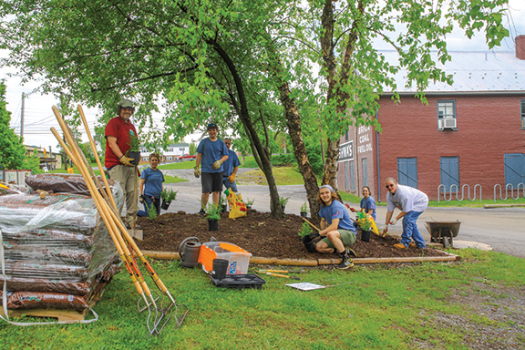
 Spanning 184.5 miles and 20,000 acres, the C&O Canal National Historical Park welcomes nearly 5 million visitors each year. That’s a lot of land for the National Park Service to maintain! As the official nonprofit partner of the Park, the C&O Canal Trust is happy to help out, assisting Park staff in preservation and maintenance projects year-round to keep the C&O Canal clean and beautiful.
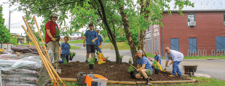