
Most people think of the C&O Canal as a place for outdoor recreation, but the park is designated as a national historical park because of its rich history. The canal’s history is multi-faceted, from its use as a transportation route with over 1,000 historic structures to its strategic location along the Potomac during the American Civil War and beyond. Today it’s not only a great place to enjoy the outdoors, but it’s a treasure trove for history enthusiasts.
You can explore by region: East | Central | West
You can also copy this itinerary into our C&O Canal Itinerary Builder here.
East: DC to Brunswick
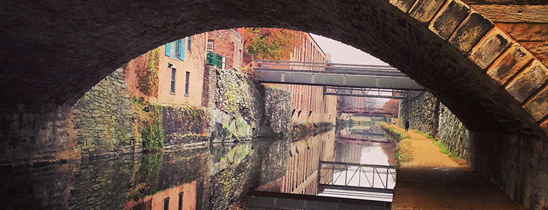
Mile marker 0.0 Georgetown
Georgetown is situated on the Fall Line and was the farthest point upstream that oceangoing boats could navigate the Potomac River. Established in 1751 as a tobacco port town, Georgetown is where the C&O Canal begins. The creation of the C&O Canal provided an economic boost to the area. Transportation of goods such as tobacco, sugar, and molasses from the West Indies, as well as salt from Europe, passed through Georgetown. These shipping industries were later replaced by coal and flour industries, until they declined in the late 19th century. A flood in 1890, coupled with the expansion of the railroads, brought destitution to the canal, and Georgetown’s waterfront became more industrialized. The shipping trade vanished from Georgetown between the Civil War and World War I. In 1967 the Georgetown Historic District was listed on the National Register of Historic Places.
Mile marker 0.4 Douglas Bust
Supreme Court Justice William O. Douglas played an integral part in saving the canal from being turned into a parkway during the 1950s. His love for the canal led him to challenge editors from The Washington Post to hike the entire 184.5 miles of towpath with him to see why the space should be left untouched. His efforts provided a focal point for media attention and intensified the efforts of conservation groups who sought to preserve the canal. Thanks to his efforts, the National Park Service abandoned the parkway idea.
Mile marker 7.6 Glen Echo Park and Clara Barton House
The bluffs above Lock 7 were the site of a Chautauqua, an adult education and social movement in the United States, highly popular in the late 19th and early 20th centuries. This one had only one successful season in 1891. Glen Echo Amusement Park then occupied the site, becoming the area’s premier amusement park until 1968. The National Park Service acquired the site, removed some of the amusement structures, and opened the park to the public in 1970. Since then the park has offered cultural and educational programming, and visitors can ride the historic Dentzel Carousel.
Just upstream from Glen Echo is the Clara Barton House, where Clara Barton spent the last 15 years of her life. Barton, known as the “angel of the battlefield,” was a volunteer nurse and relief worker during the Civil War. She later founded the American chapter of the Red Cross. Barton lived in the house, which served as a working headquarters for her relief operations, until her death in 1912. Today the house is managed by the National Park Service and periodically open to the public for tours.
Mile marker 22.8 Seneca Stone Cutting Mill
Seneca Stone Cutting Mill operated from 1837 to the early 1900s, milling stone from Seneca Quarry for many structures on the canal and public buildings in Washington, D.C., including the iconic Smithsonian Castle on the National Mall. The mill’s water wheel, and later a turbine, were powered by water from the canal. Seneca Stone Cutting Mill also cut granite and stone shipped from neighboring quarries. Granite and marble used in the U.S. Capitol and the Washington Monument were cut here.
Canal in Georgetown. Photo by Tim Walters
Mile marker 35.5 Whites Ferry
Until it closed in 2020, Whites Ferry was the last operating ferry on the Potomac River, transporting vehicles, cyclists, and pedestrians from Maryland across to the Leesburg area of Virginia. The ferry dates back to the early 1800s and gets its name from former Confederate Lieutenant Colonel Elijah White, who owned a nearby farm and purchased the ferry after the Civil War.
Mile marker 44.6 Nolands Ferry
Nolands Ferry was an important crossing on the Potomac River even before the United States was a nation. Native Americans crossed here traveling from the Susquehanna River southward through Maryland to the Carolinas. Licensed ferry operations date back to 1735, with the Noland family operating the ferry here as early as 1758. Thomas Jefferson crossed the Potomac here on May 10, 1776, en route to Philadelphia to sign the Declaration of Independence. It was also the site of several Revolutionary War crossings, used by the colonists and the British. The ferry was surrounded by a thriving community but that faded with the construction of the Point of Rocks Bridge across the Potomac.
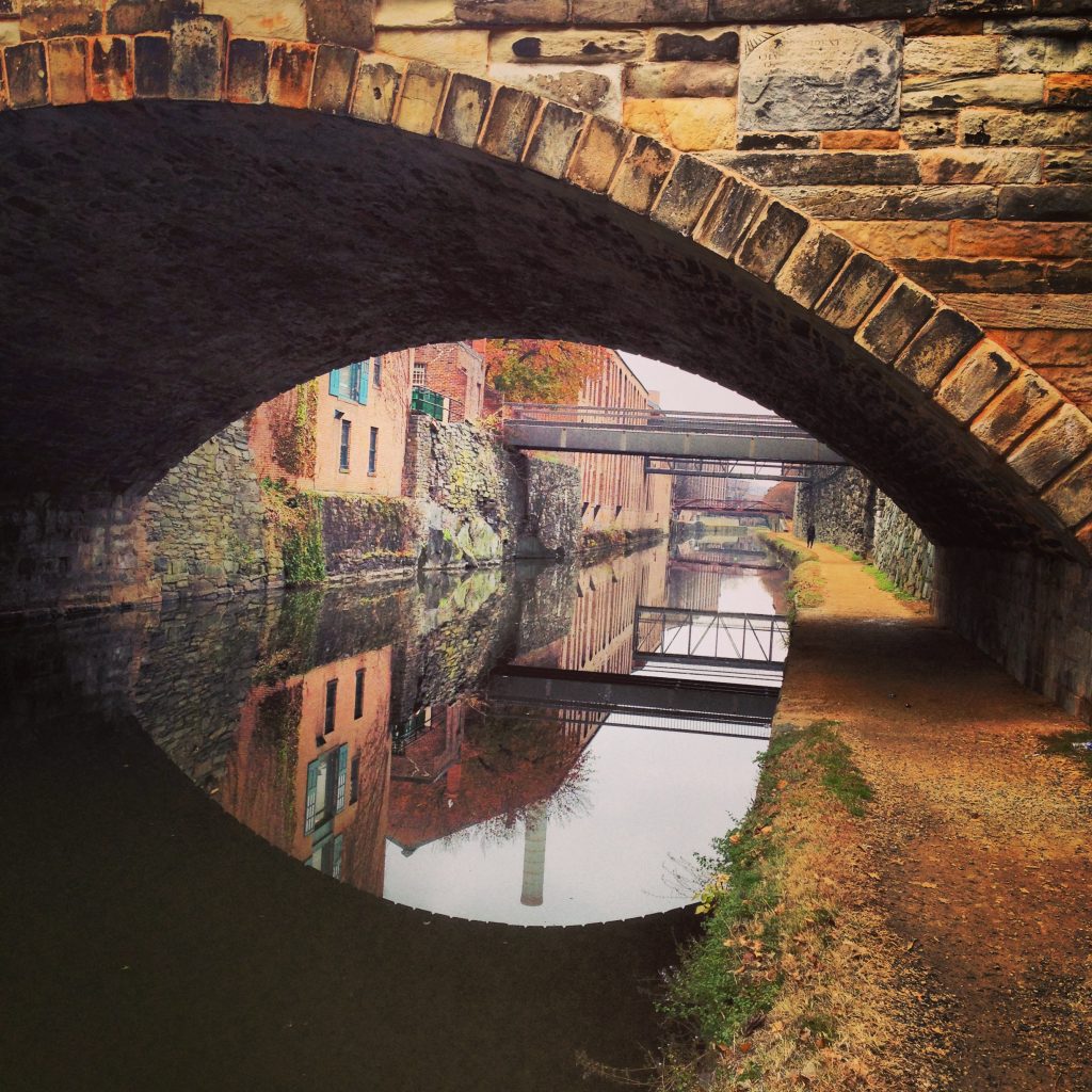
Mile marker 48.2 Point of Rocks Railroad Station
The Point of Rocks Railroad Station, considered one of the most picturesque railroad depots in the nation, was built when the B&O’s connector line to Washington was constructed in the late 1860s. Its location, where the two lines meet, is truly unique. The station is unusually sophisticated for its rural setting, done in the Victorian Gothic Revival style. The station is a testament to the significance of the railroad in post-Civil War America. It was placed on the National Register of Historic Places in 1973 and is still used by CSX, the successor to the B&O Railroad, as an office.
Mile marker 50.0 Point of Rocks Trail Tunnel
The rivalry between the C&O Canal and the B&O Railroad came to a head in the mid 1800s when continuation of both the Canal and the railroad tracks required passage through the narrow Point of Rocks section of the Potomac River basin. The B&O bought up much of the land in this stretch, but the C&O countered with a claim that it had the rights to the route based on a previous charter. It was eventually ruled the C&O Canal must share the right of way with the railroad as far as Harpers Ferry. To provide a little more breathing room through this very tight squeeze, the railroad built tunnels through two spurs of the Catoctin ridge following the Civil War. Once the Canal was out of business, the B&O ran tracks around the outside of the tunnels as well, and the Canal unfortunately became a dumping ground for the railroad.
Point of Rocks Railroad Station.
Central: Brunswick to Hancock
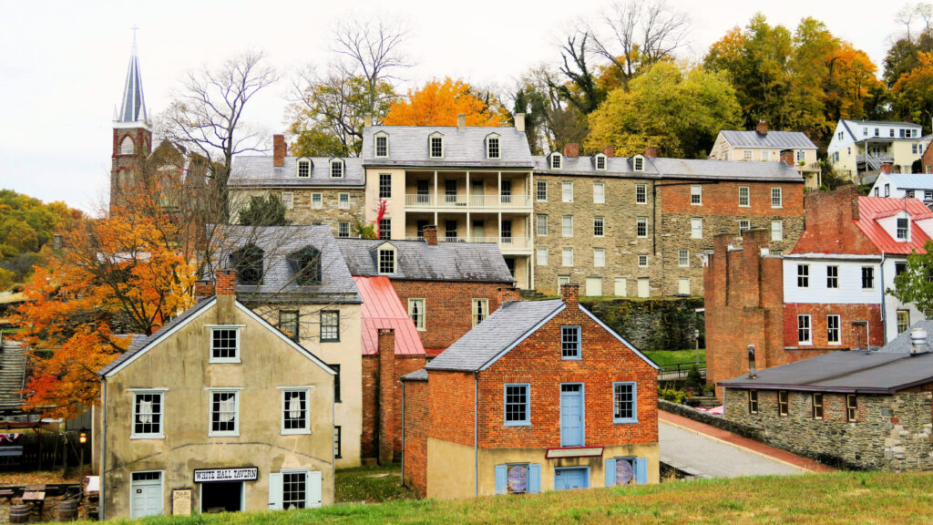
Mile marker 60.8 Harpers Ferry
On the night of October 16, 1859, abolitionist John Brown marched his “army of liberation” down the C&O Canal towpath and crossed the B&O Railroad Bridge into Harpers Ferry to raid the federal armory. The historic town of Harpers Ferry, much of which is part of Harpers Ferry National Historical Park, is a must-see for history buffs. Several historical eras are interpreted for visitors, from the Industrial Revolution to the Lewis and Clark Expedition and the Civil War to the Civil Rights Movement.
Mile marker 69.5 Antietam Village and Antietam Ironworks
The remnants of the once-thriving village of Antietam and the old limekilns from Antietam Ironworks are just beyond the stone bridge over Antietam Creek. Located at the confluence of Antietam Creek and the Potomac River, this was the site of extensive iron-working facilities for most of the century following 1765. Pig iron was the major product. During the Revolutionary War, craftsmen forged cannons, cast cannon balls, and turned out muskets at Antietam Ironworks. In 1786, metal parts for James Rumsey’s experimental steamboat were forged here. Powered by water from the Antietam Creek, the village had a rolling mill, slitting mill, nail factories, large grist mill, limestone crushing mill, spinning mills, hemp mills, flour mills, sawmill, shingle mill, cooperage factory, woolen mill, and stove works at various times. During the Maryland Campaign of 1862, General Ambrose Burnside’s Ninth Army Corps passed through the village on its way to Sharpsburg. The ironworks suffered some damage during the Civil War but was rebuilt and operated until 1882. Antietam Village and Antietam Ironworks are on the National Register of Historic Places.
Mile marker 71.4 Packhorse Ford
Also known as Blackford’s Ford, Boteler’s Ford, and Shepherdstown Ford, this is the site where Stonewall Jackson’s Command crossed en route from Harpers Ferry to Sharpsburg to join Confederate forces on September 17, 1862, during the Battle of Antietam. This is also where the entire Army of Northern withdrew into Virginia on September 18 and 19.
Mile marker 72.6 James Rumsey Monument and State Park
Just across the Potomac River on top of the cliff is the James Rumsey Monument and State Park. James Rumsey was a pioneer of steam navigation and was the first superintendent of the Patowmack Company, a position that George Washington recommended him for. On December 3, 1787, Rumsey’s steamboat, which used a type of hydraulic jet-propulsion, made its debut in this calm section of the Potomac River. Hundreds of spectators witnessed the craft make its way upstream from the Shepherdstown ferry landing at a rate of four miles per hour. A 75-foot monument sits on the hillside to commemorate Rumsey’s first-in-steam navigation.
View of Harpers Ferry from Towpath. Photo by MJ Clingan
Mile marker 72.8 Ferry Hill Plantation
Ferry Hill sits on the high bluff overlooking the Potomac River and the C&O Canal, opposite Shepherdstown. The property has been a farm, a restaurant, an encampment for Union troops, and, at one time, the headquarters for the C&O Canal National Historical Park. Ferry Hill was built by Col. John Blackford in 1813 and once encompassed 700 acres. Blackford had one of the largest slaveholdings in the area, owning 18 slaves and hiring part-time laborers as well. In 1850 the Douglas family moved into the mansion with their four children, which included Henry Kyd Douglas. Henry enlisted in the Confederate army in 1861 and served as Stonewall Jackson’s youngest staff officer. Maryland was a border state but because Henry enlisted as a Confederate, the Federals kept the Douglases under house arrest for much of the Civil War. Ferry Hill was used by both armies during the war and wounded Confederates were cared for here following the September 17, 1862, Battle of Antietam. Henry’s father Robert was suspected of spying for the Confederates. The Federals arrested him and sent him to Fort McHenry, in Baltimore, for several months.
Located approximately 5 miles from the C&O Canal, Antietam National Battlefield is the site of the bloodiest single-day battle in American history. After three phases of fighting, more than 23,000 soldiers were dead, missing, or wounded. The September 17, 1862, battle ended in a draw, but was considered a strategic victory for the North, preventing England and France from intervening. Following the battle, President Abraham Lincoln issued the preliminary Emancipation Proclamation, making slavery an official issue of the war.
Mile marker 75.7 Killiansburg Cave
After the Battle of South Mountain, as the Confederate army retreated and settled in Sharpsburg, the town residents felt the tension mounting between the Confederates and the Federals. Many families left their homes to go stay with nearby relatives while others found refuge in caves, including the Killiansburg Cave, along the Potomac River. Out of the line of fire, the caves provided a safe haven for residents to gather until the battle ceased.
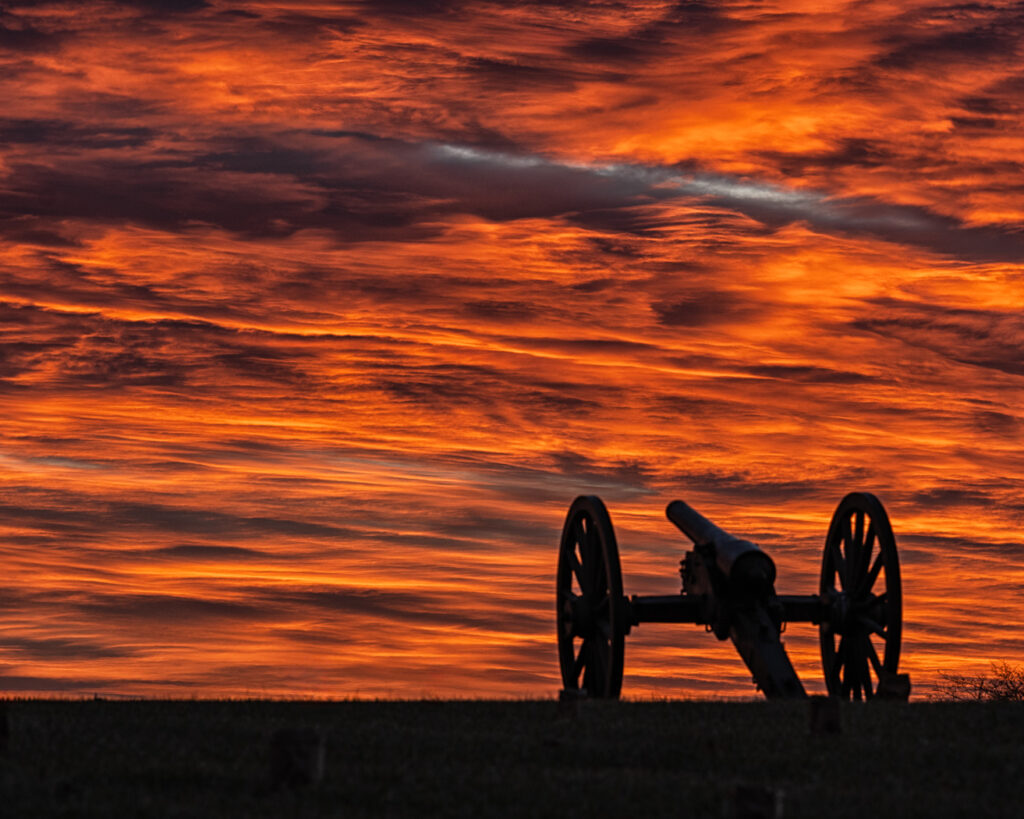
Sunset at Antietam Battlefield. Photo by Kim Cawley
Mile marker 94.44 Falling Waters
Following the Confederate defeat at the Battle of Gettysburg, General Robert E. Lee and his troops withdrew into Maryland. Rain and high water levels made a retreat back into Virginia difficult so the army worked on making pontoon boats. Water levels subsided enough for the army to cross over fords at Falling Waters and also Williamsport, under darkness.
Mile marker 99.2-99.8 Williamsport
Williamsport is the only place on the canal where examples of major canal structures can be viewed within a half-mile stretch of the towpath. Visitors can see a refurbished lockhouse and its adjacent lift lock, the only Bollman Iron Truss bridge over the canal, a railroad lift bridge, a canal turning basin and a re-watered aqueduct. The railroad lift bridge is a rare surviving example of a short-span railroad vertical lift bridge. It was built in 1923 by the Potomac Public Service Company, where the Western Maryland Railway spur crosses the canal. Cushwa Basin is the only restored historical basin on the C&O Canal. The basin was excavated and rebuilt in 1994. The Cushwa warehouse was built between 1790 and 1810, predating the canal. It is one of the oldest buildings along the canal. Adjacent to the basin, on its downstream side, was the Cushwa wharf. This, along with the Steffey and Findlay wharf near Lock 44, made Williamsport the most important coal shipment point on the canal above the Federal District. Replica launch boat rides over the re-watered Conococheague Aqueduct are offered seasonally. Check the website for a current schedule.
Mile marker 110.2 McCoys Ferry
Union and Confederate troops clashed several times at McCoys Ferry throughout the Civil War, On May 23, 1861, Confederate forces tried to capture the ferry boat but were halted by fire from the Clear Spring Guards. They let the boat drift downstream where Union soldiers later retrieved it. On October 10, 1862, less than one month after the Battle of Antietam, Confederate General J.E.B. Stuart and his cavalry crossed the Potomac River at McCoys Ferry on his second ride around McClellan’s army. Part of the Confederate cavalry in the McCausland-Johnson raid crossed the Potomac here on July 24, 1864. The cavalry was on its way to Chambersburg, Pennsylvania, where it burned the town after residents refused to pay a ransom.
Mile Marker 112.4. Fort Frederick
Fort Frederick State Park borders the Potomac River and surrounding parts of the C&O Canal. Within the park is Fort Frederick, built from 1756-57 at the request of Governor Horatio Sharpe to protect the frontier. It is the only remaining stone fort from the French and Indian War. It was also used during the Revolutionary War and the Civil War, when Union troops were often stationed at the fort to guard the canal. Today the fort and surrounding area is a Maryland State Park. Visitors can enjoy tours of the fort, interpretive programs, and living history programming throughout much of the year.
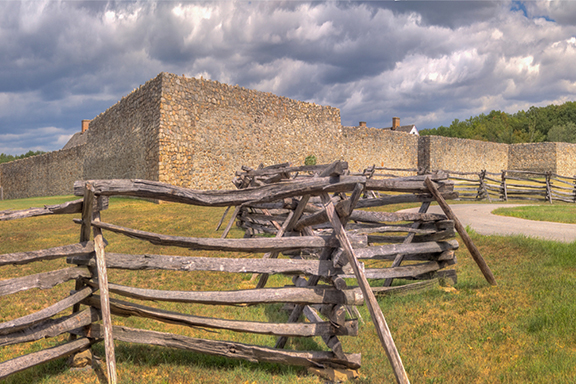
Fort Frederick. Photo by John Gensor.
West: Hancock to Cumberland
Mile marker 155 Paw Paw Tunnel
Made up of six million bricks and at three-fifths of a mile long, the Paw Paw Tunnel is considered the most notable landmark and greatest engineering marvel on the C&O Canal. It took 14 years and cost more than $600,000 to complete, coming in way over budget. The tunnel was built to eliminate six miles of canal and cut across a neck of land formed by the Paw Paw bends. Immigrant laborers worked on the tunnel in difficult conditions. A great deal of labor unrest including riots, strikes, violence, and even arrests, disrupted progress on the tunnel.
Mile marker 166.7 Oldtown
Oldtown’s history dates back thousands of years to early Native American settlements in the area. Five of their trails passed through Oldtown; in fact, the town’s original name was Shawnee Oldtown. In the early 1740s, frontiersman Thomas Cresap established a fort near the Potomac River. His son, Michael, was the first white male born in Allegany County. Today, one of the oldest structures in Allegany County is the 1764 Michael Cresap House. George Washington crossed the Potomac here in 1748 when he was in his teens, working on a survey mission. The low water crossing of the Potomac River at Oldtown made it a popular spot for troops to cross during the French and Indian War and again later during the Civil War. Several Civil War incidents at Oldtown affected the canal and the B&O Railroad. In August of 1864, after burning Chambersburg and occupying Hancock, Confederate troops threatened Cumberland. Union forces amassed an unsuccessful attempt to trap Brigadier John McCausland’s Confederate raiders behind Union lines in the Battle of Oldtown on August 2.
Mile marker 182.6 Wiley’s Ford
On the night of February 21-22, 1865, about 65 men known as McNeil’s Rangers crossed the Potomac River near Brady’s Mills and entered Cumberland, while approximately 8,000 Union troops were encamped there. The rangers captured Generals Kelly and Crook while they were sleeping and took them, along with their horses, down the canal to Wiley’s Ford where they crossed into Virginia. The generals were taken to Richmond where they were held in captivity.
Mile marker 184.6 Cumberland
Cumberland, established as a town in 1787, was once the second largest city in Maryland. During the Industrial Revolution the mountains of the Cumberland region provided coal, iron ore and timber, which turned the city into a key manufacturing center. Other industries took off as well, like glass, breweries, fabrics, and tinplates. Prior to the arrival of the railroad and the canal, the National Road brought travelers to Cumberland. The railroad made it to Cumberland in 1842, followed by the canal in 1850. At that time, use of the National Road began to decline. The last stagecoach line stopped operating in 1853. During much of the Civil War, Union General Benjamin Kelley’s troops, headquartered in Cumberland, were responsible for protecting the B&O Railroad and the canal. Following World War II, industry in Cumberland began to decline, as did the population. Today, Cumberland is a member of the Canal Towns Partnership and features a variety of shopping and history for tourists to discover.
Written by: Charissa Hipp