
Wheelzup Adventures
Wheelzup Adventures is a full-service bike shop that also includes a shuttle service and bike storage. Wheelzup Adventures is located in the Shops at Canal Place on the western side […]
Baltimore Street Grill
Baltimore Street Grill is an easy-going pub serving classic bar food, Cajun food, and draft brews. At the terminus of the C&O Canal, continue onto the Great Allegheny Passage. Turn […]
Uncle Jack’s Pizzeria & Pub
Uncle Jack’s serves pizza, burgers, sandwiches, wings, pasta, and 15 beers on tap. They have live music and entertainment on the weekends. At the terminus of the C&O Canal, turn […]
Chopsticks Chinese Restaurant
Chopsticks Chinese Restaurant has been serving the Cumberland area for over a decade. They serve reasonably priced fresh food. At the terminus of the C&O Canal, continue onto the Great […]
City Lights
City Lights is an Americans grill and bar with outdoor seating. They serve fresh seafood and homemade pies. At the terminus of the C&O Canal, continue onto the Great Allegheny […]
Crabby Pig
Our goal is to provide you, your friends, and your family with a fun and relaxing dining experience. So, sit down, relax, and enjoy the best crab cakes, homemade soups, […]
Culinaire Café of ACM
Culinaire Café offers lunch entrées and desserts prepared by students in training for careers in the hospitality sector. At the terminus of the C&O Canal, continue onto the Great Allegheny […]
MEZZOS
Mezzos is an upscale bar that serves cocktails and American food in tapas style. At the terminus of the C&O Canal, turn right and follow Canal Place and then turn […]
JJs & Sons Pizzeria
A family-owned pizzeria since 1981, JJ’s & Sons serves pizza, subs, and wings for lunch and dinner. At the terminus of the C&O Canal, turn right and follow Canal Place. […]
Café Mark
Café Mark serves breakfast and lunch, coffee, smoothies, and baked goods. At the terminus of the C&O Canal, continue onto the Great Allegheny Passage. Turn right on Baltimore St., and […]
Curtis’ Coney Island Weiners
Curtis Famous Weiners has been serving old fashioned hotdogs and burgers to the community since 1918. At the terminus of the C&O Canal, continue onto the Great Allegheny Passage. Turn […]
All that to go & Bakery
All That To Go Bakery is a soul food bakery serving southern-inspired fast food including vegan options. At the terminus of the C&O Canal, continue onto the Great Allegheny Passage. […]
Corner Tavern & café
Corner Tavern & Café is a breakfast, lunch, happy hour, and late night spot. They serve coffee, craft cocktails, microbrews, sandwiches, wraps, and salads, and have gluten-free and vegetarian options. […]
Queen City Creamery Scoop Shop
Queen City Creamery has frozen treats, coffee, sandwiches, and alcoholic milkshakes. At the terminus of the C&O Canal, turn right on Canal St. and left on Canal Pl. Continue for […]
European Desserts and More
European Desserts and More has desserts made fresh daily, sandwiches, soups, and ice cream. European Desserts is located in the Shops at Canal Place on the western side of the […]
Basecamp Coffee Company
Basecamp Coffee Company serves Royal Coffee and other responsibly-sourced brands. At the terminus of the C&O Canal, follow the path around the train station and turn right to cross the […]
Caporale’s Bakery
Caporale’s Bakery has been in Cumberland for over 100 years. They are known for their fresh-baked pepperoni rolls and Italian bread. At the terminus of the C&O Canal, turn right […]
Cumberland Heritage Days
[start-date] 10:00 am – [end-date] 5:00 pm Area’s largest street festival. Something for everyone from arts and crafts, kids’ activities, entertainment, to lots of food and special events all around […]
Paw Paw
Paw Paw, West Virginia is a small town located near a section of the Potomac River that contains five horseshoe-shaped bends. Town and bends are named after the native paw […]
Canal Place Parking
Parking is available in the Station Square lot opposite the Western Maryland Railway Station or at the Harrison Street lot. All parking fees are collected using the Parkmobile app.
Trailhead – Western Maryland Rail Trail West
This is the western trailhead of the Western Maryland Rail Trail. For infomation on the eastern trailhead visit Western Maryland Rail Trail: East Trailhead.
Mule Statue at Canal Place
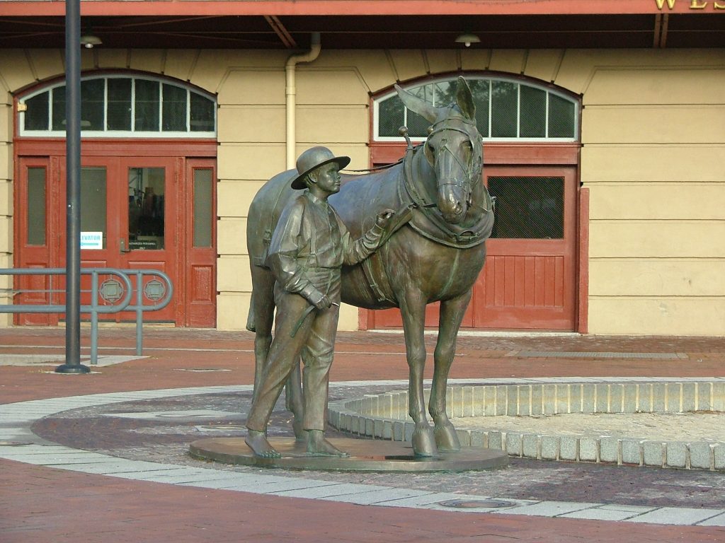
A mule and his driver are cemented in time here at Canal Place. A popular photo site, the statue sits in front of the former Western Maryland Railway station, now […]
Allegany County Historical Society
Founded in 1937, the Allegany County Historical Society is a 501c3, education-based non-profit organization with a mission to share the community’s rich history through museums, special collections and programming.
Canal Boat Replica
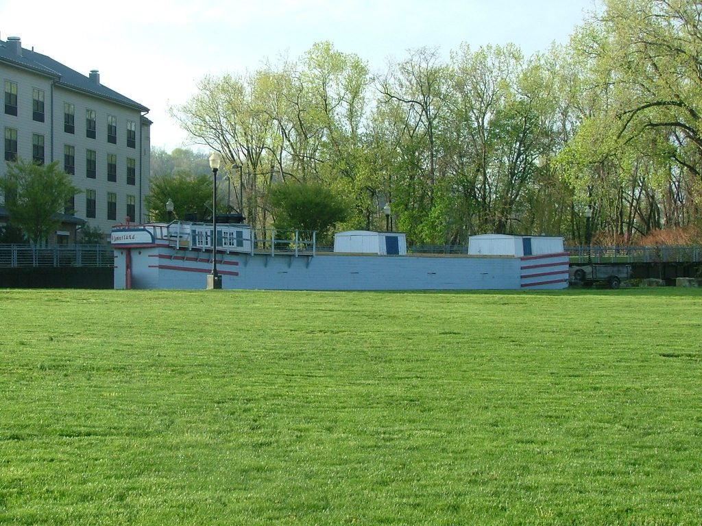
A replica canal boat, “The Cumberland”, is available to be viewed in the Festival Grounds of Canal Place. For guided tours check with the C&O Canal Museum and Visitor Center […]
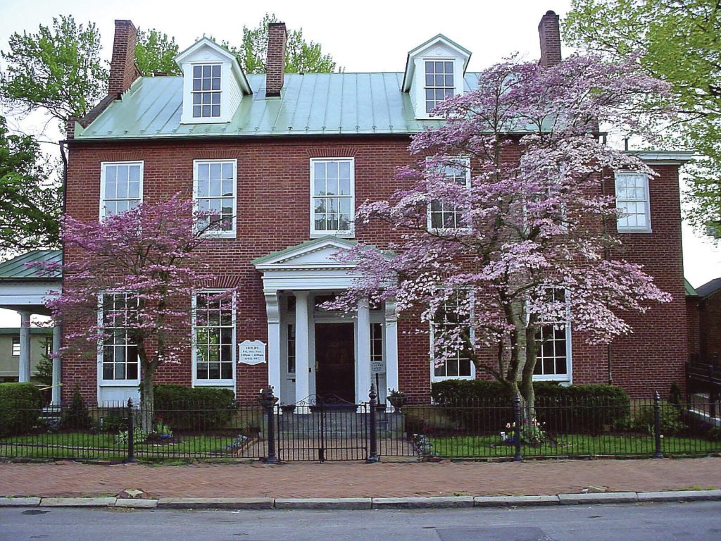
The Gordon-Roberts House
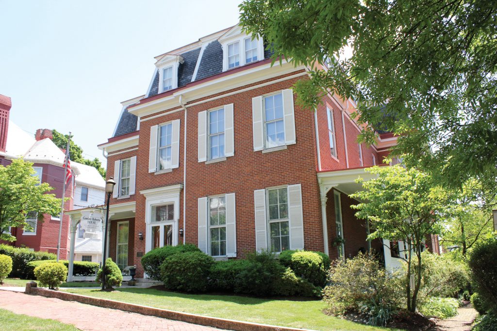
The Gordon-Roberts House was built in 1867 by Josiah Hance Gordon, a prominent attorney in Cumberland.The Second Empire style home is operated as a house museum and is opened to […]
C. William Gilchrist Gallery and Museum
The Gilchrist Gallery and Museum is a charming early 19th-century Federal mansion, built in a transitional Federal-Greek Revival architectural style. Inside are six renovated galleries and an art library, with […]
George Washington’s Headquarters
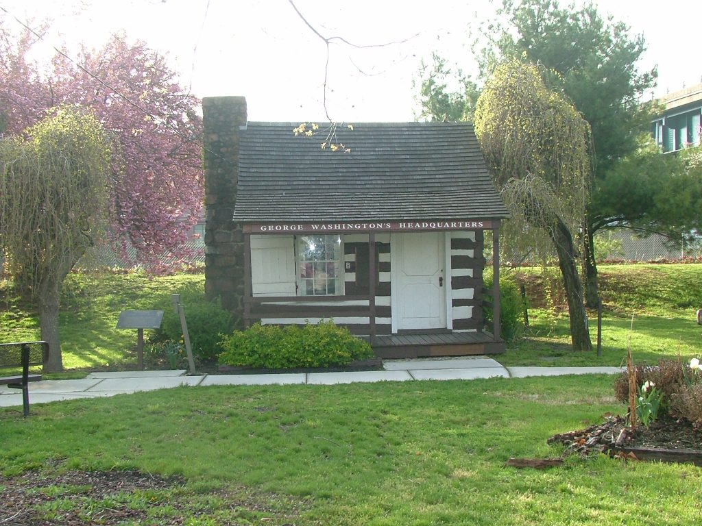
Historic log cabin in Cumberland, Maryland, which served as Washington’s headquarters during the French and Indian War and briefly during the Whiskey Rebellion
Allegany Museum
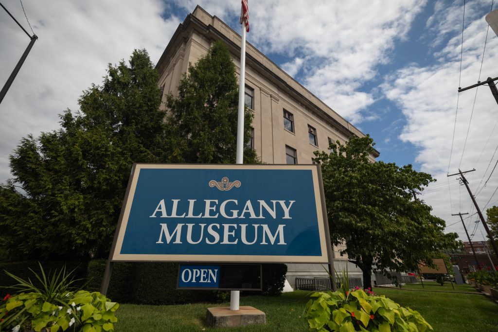
Local history museum focusing on the crossroads of American history with interactive exhibits.
C&O Canal Museum and Visitor Center in Cumberland
The C&O Canal National Historical Park’s Cumberland Visitor Center is located in the historic Western Maryland Railway Station in Cumberland, MD. It serves as a museum dedicated to the history […]
National Road Monument
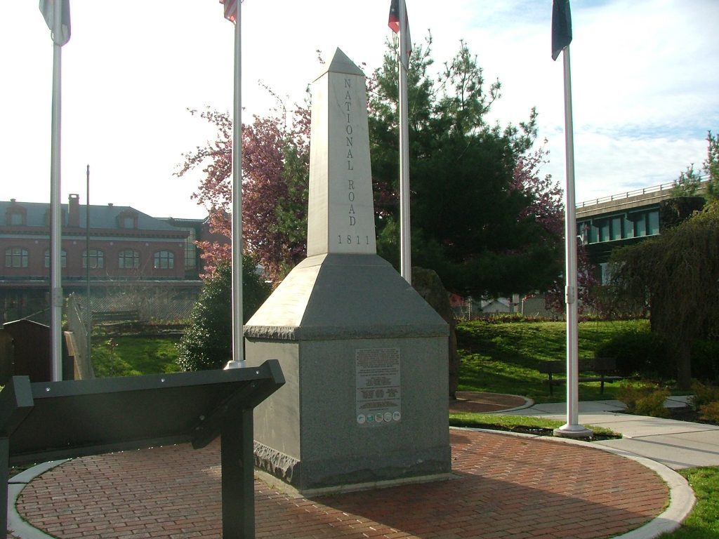
This monument commemorates the 200th anniversary of the National Road’s construction, which began in 1811. The monument is situated at the approximate start of the road’s original route on Greene […]
Cumberland Historic City Center
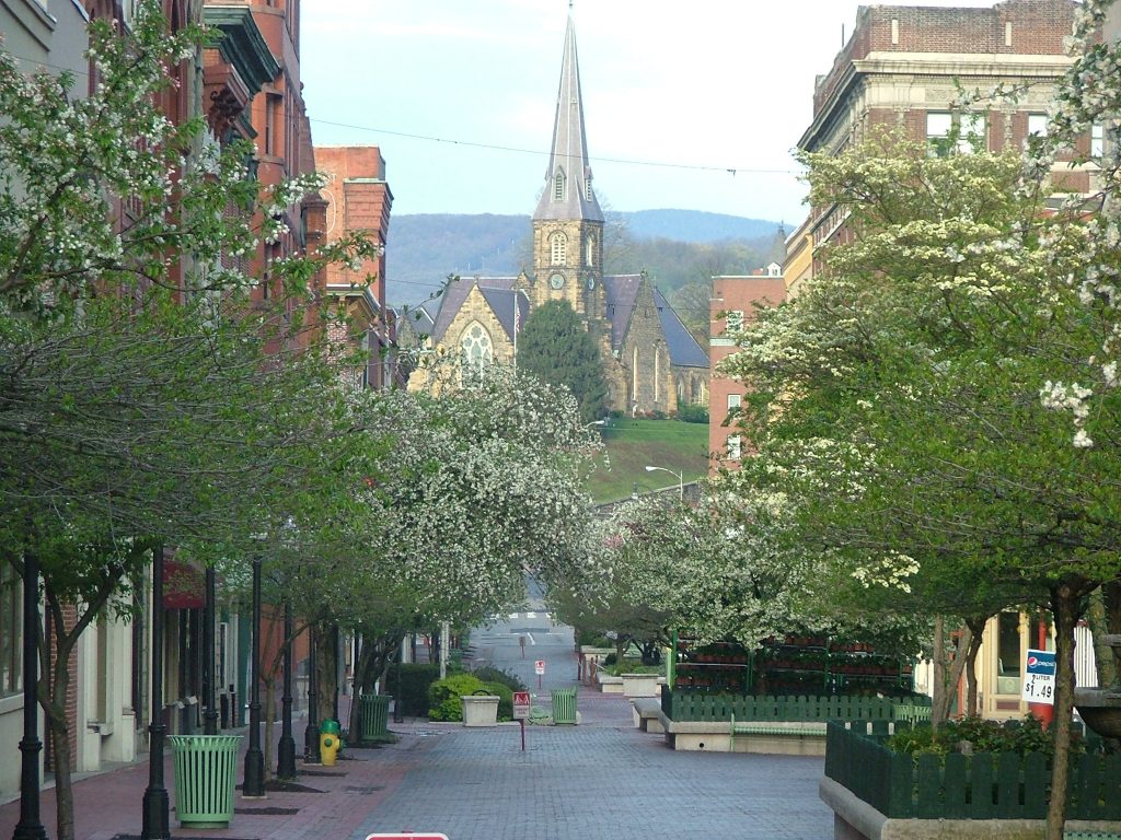
Cumberland’s Historic City Center is a three-block brick pedestrian mall with restaurants, unique shops, and art galleries housed in significant turn-of-the-century architecture. A hub of outdoor activity, Baltimore Street hosts some […]
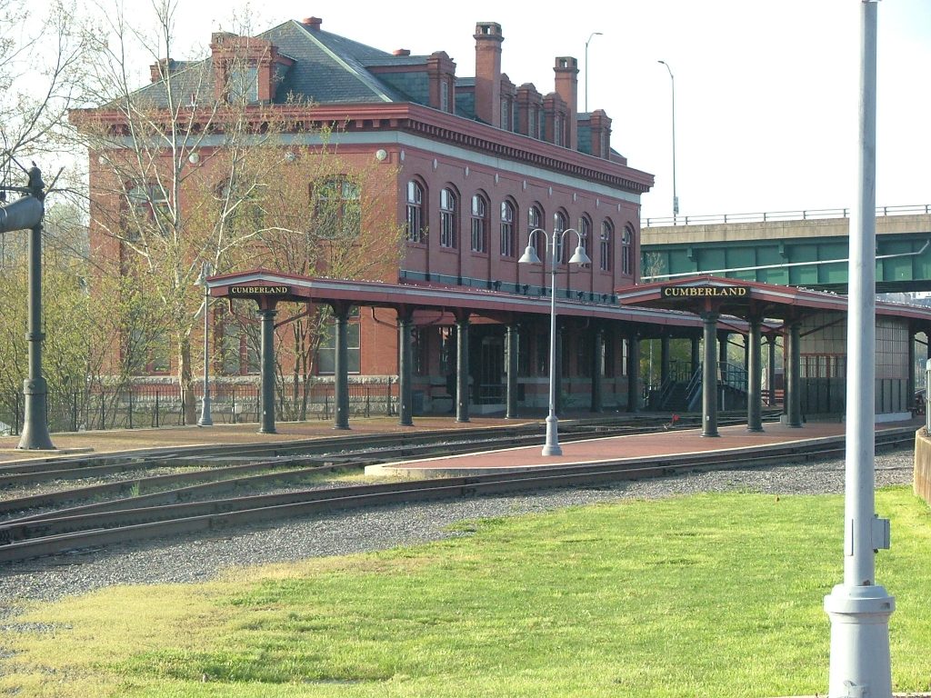
Western Maryland Scenic Railroad Station
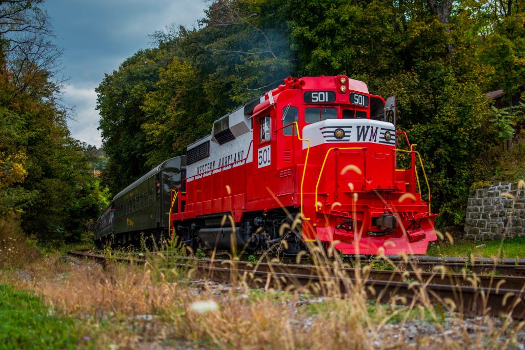
Daytime scenic excursions leave the Western Maryland Scenic Railroad Station for three hour round trips to Frostburg, with a one hour stop, before making the return trip. Check out the […]
Cumberland
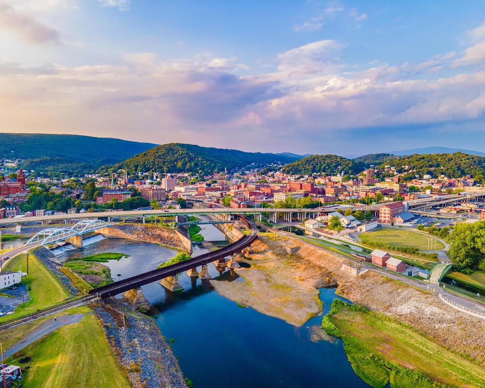
Cumberland is a beautiful town nestled in one of the few natural passable cuts in the Allegheny Mountains of Western Maryland. It is listed in the National Register of Historic […]
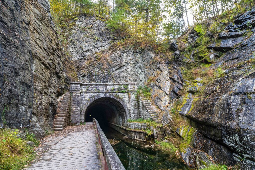
Terminus
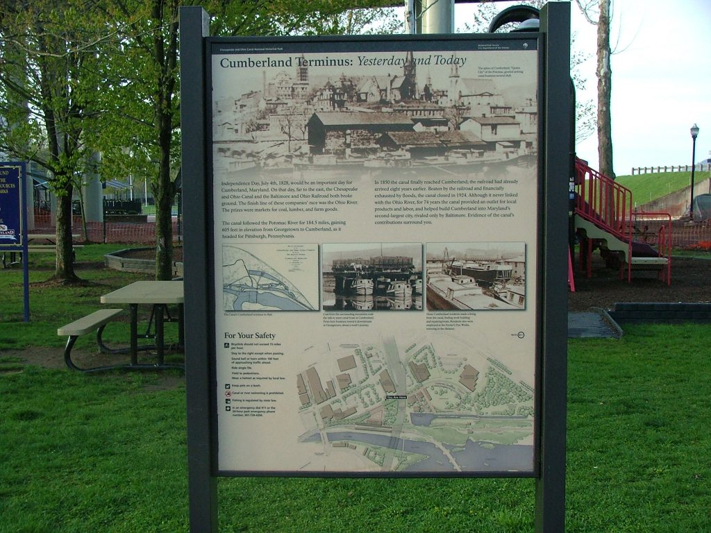
Cumberland may be the end of the C&O Canal, but it was also once known as the “Gateway to the West.” The Potomac River cuts through the mountains in and […]
Shrivers Basin and Main Basin
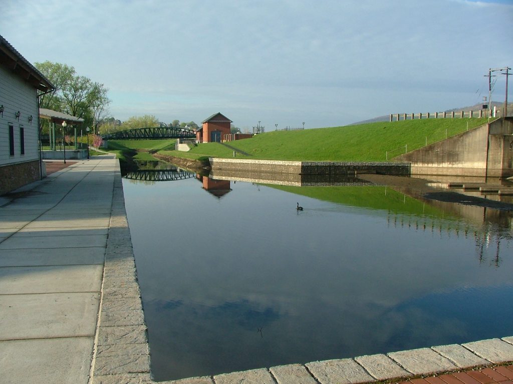
Near downtown Cumberland, the Canal divided into two elongated turning basins for boats: Main Basin and the broader Shriver Basin. Shriver Basin angled inland from the dividing spot and Main […]
Candoc Recreation Area Parking
Small lot off Candoc Lane, near Candoc Recreation Area.
Evitts Creek Aqueduct
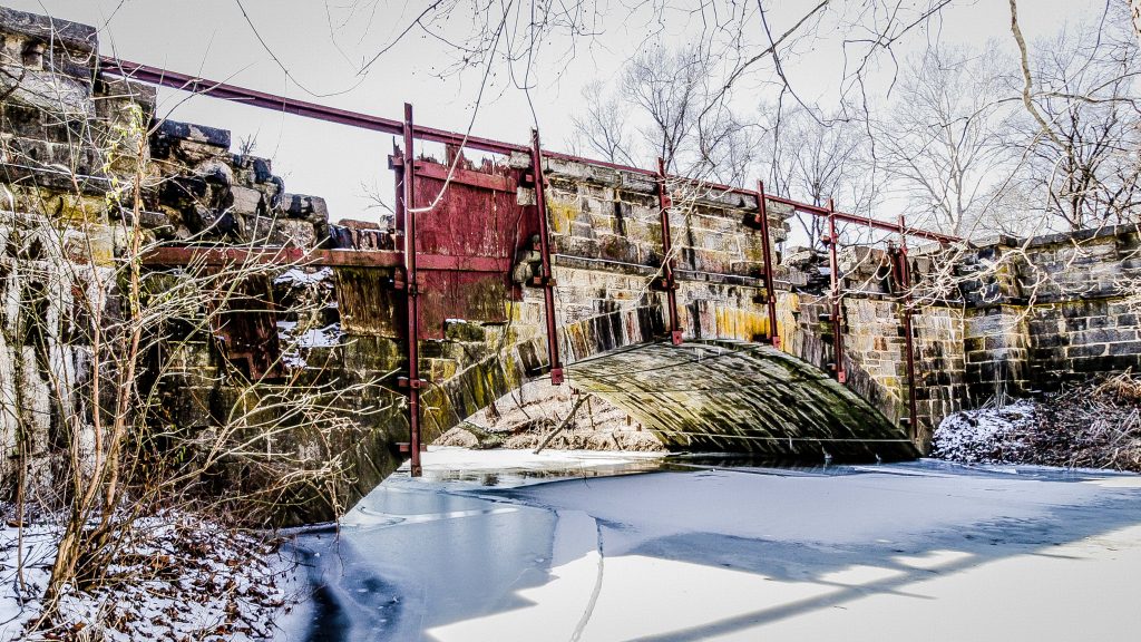
The Evitts Creek Aqueduct is the last of the 11 aqueducts on the Canal, and is made of “Fossilferous Tonoloway Limestone” quarried upstream and shipped to the aqueduct via a […]
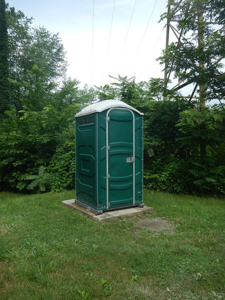
Evitts Creek Restroom
Evitts Creek Campsite Hand Pump
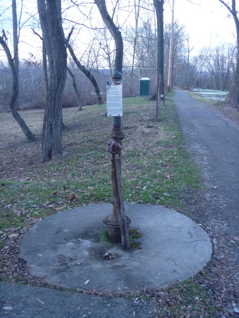
Please Note: Potable water may not be available at each campsite. Water is treated with iodine. Please plan to have water purification tablets with you. Water is turned off from […]
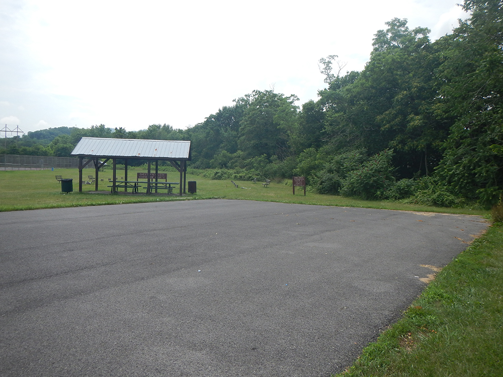
Evitts Creek Campsite
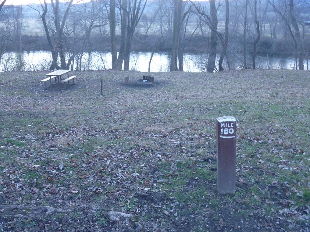
Please visit the C&O Canal National Historical Park’s website for detailed camping information, or you can call 301-739-4200 with any questions. Site reservations can be made via the Recreation.gov website.