
Itineraries
Cum to Will
The western section of the C&O Canal National Historical Park begins in Hancock (mile marker 124.0) and travels through the mountains of Maryland in Washington and Allegany Counties to Cumberland (mile marker 184.5). This section of the park is very rural, with beautiful vistas and a woody retreats. In Cumberland, the C&O Canal ends, but joins the Great Allegheny Passage, which travels to Pittsburgh, PA.
Explore the western section of the Park with this itinerary here, or copy this itinerary by clicking “Save to My Itineraries” above and use it to explore the C&O Canal! (You have to be logged in to use the itinerary builder. Learn how here.)
- 1
 Cumberland
Town/Location - 2
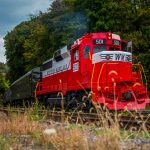 Western Maryland Scenic Railroad Station
Discovery at Mile 184.5 - 3
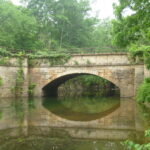
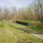
 Evitts Creek Aqueduct
Mile 180.7 - 4
 Town Creek Aqueduct
Mile 162.4 - 5
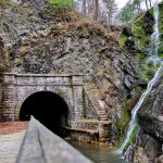 Paw Paw Tunnel
Discovery at Mile 155.0 - 6
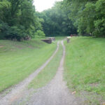
 Green Ridge State Forest
Mile 144.0 - 7
 Fifteenmile Creek Aqueduct
Mile 141 - 8
 Sideling Hill Creek Aqueduct
Mile 136.6 - 9
 Hancock
Town/Location - 10
 Tonoloway Aqueduct
Mile 123.0 - 11
 Licking Creek Aqueduct
Mile 116.1 - 12
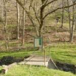
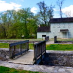
 Lockhouse 49: Canal Quarters
Canal Quarters at Mile 108.9 - 13
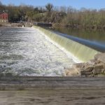 Dam 5/Guard Lock
Discovery at Mile 106.6 - 14
 Lockhouse 44
Discovery at Mile 99.1 - 15
 Conococheague Aqueduct
Discovery at Mile 99.6 - 16
 Williamsport
Town/Location - 17
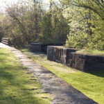
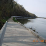 Big Slackwater
Mile 85.6 - 18 Big Slackwater
Mile 85.6