
At 184.5 miles long and with more historical structures than any other national park, the C&O Canal National Historical Park is always a work in progress. This summer, however, visitors will be able to enjoy the fruits of several big projects nearing completion.
Towpath Resurfacing
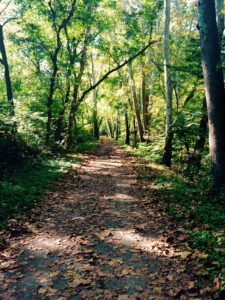
Sections of the towpath resurfaced so far include Edwards Ferry (Mile 30.8) to White Ferry Mile 35.5) and from Brunswick Family Campground (Mile 54) to Dargan Bend (Mile 64.9). The Park anticipates completing rehabilitation of the towpath all the way to Packhorse Ford near the Shepherdstown Bridge this year. Horseback riders are asked to stay off the newly-resurfaced sections for about three weeks to give the new stone dust surface time to harden.
Locks 3 & 4 Project (Georgetown)
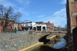
The canal has been re-watered from Fletchers Cove to Georgetown! A small section of the canal will remain dry to facilitate replacement of the 31st Street bridge by the District of Columbia. Water is being channeled through the dry area via a pipe.
Locks 5-22
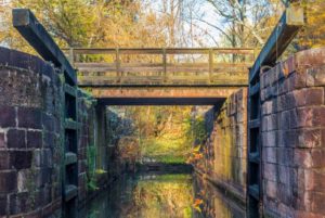
Work is close to complete on the water management structures between Lock 5 (Fletchers Cove) to Lock 22 (Violettes Lock/Inlet Lock 2). The Park has re-watered the canal from Pennyfield to Violettes Lock, and will re-watering from Great Falls to Pennyfield once work is finished on Lock 19 in July, at which time the Charles F. Mercer boat operation will resume.
Paw Paw Tunnel Rock Scaling Project
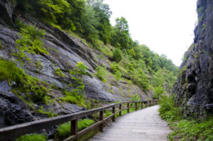
Rock scaling of the cliff above the towpath on the upriver end of the tunnel will begin as soon as the final engineering design is complete. Hikers and bikers will be able to continue to use the tunnel once the work begins, with flaggers controlling tunnel traffic when necessary.
Conococheague Aqueduct
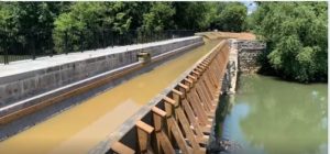
Construction on the rehabilitated aqueduct is complete! The Park has removed the Cushwa Basin to allow water to flow into the aqueduct to test if there are any leaks. Pedestrians and cyclists will be permitted to walk across the aqueduct following the ribbon-cutting on August 8.
With this change, many have wondered how it effects access to the towpath and if parking has changed. See below for information on these topics.
Alternate Parking for Towpath Access near Williamsport
1. Williamsport Visitor Center (mm 99.7) parking is still available, Visitors may cross the Railroad Lift Bridge (adjacent to Rt. 11).
2. River Bottom Park (mm 99.6), across the Bollman Bridge, is a good parking area for wheelchair, stroller, and bike trailer access to the towpath.
– Exit the parking lot and head straight up the hill (Rt.11)
Turn right onto N Vermont St
At the first intersection, turn right onto Salisbury St.
3. Lockhouse 44 (mm 99.3), this is also an ADA and stroller accessible parking area.
– Exit the parking lot and head straight up the hill (Rt.11)
Turn right onto N Vermont St
Continue straight onto Canal St
Turn left onto Main St