
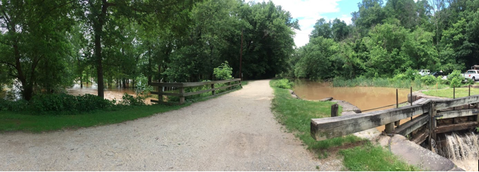
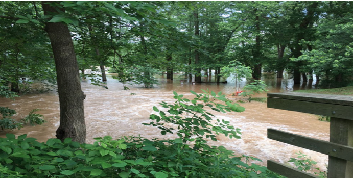
Flood History
With its location along the Potomac River, it’s not a matter of if the C&O Canal and its lockhouses will be flooded but when. The Canal has experienced flooding ranging from inconvenient to destructive throughout its history. In early June of this year, the Potomac reached its highest level in 8 years as rehabilitation work continued at Swains Lockhouse.
Renovating for Protection
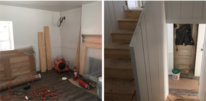
Many of the rehabilitation decisions at Swains Lockhouse have been made with an eye towards minimizing damage during future flooding. Joe Andera, superintendent of the Swains rehabilitation with contractor Vanguard Pacific LLC, explained the rationale driving his crew’s work. Beginning at floor level, all original subflooring was removed and replaced with pressure-treated subflooring and joists, as well as pressure-treated plywood on top of the existing slab. The new flooring is a Click-n-Go floating floor, easy to remove and replace in the event of flooding.
Thinking Ahead to Recovery
The walls at Swains are also designed to mitigate flood damage. All wall framing uses pressure-treated wood for moisture resistance. Perimeter walls use closed cell spray foam insulation to act as a vapor and water barrier that can be aired out after flooding. The wainscoting is backed with 3 feet of waterproof material that is easier to replace than drywall. All new electrical is placed at 36” above grade to provide some protection. The rear window in the living room has been raised 6 inches up from grade to place it above floodwaters.
Preventing Exterior Damage
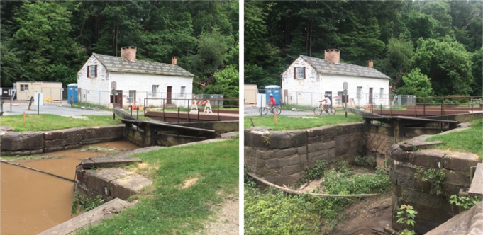
Outside the Lockhouse, some grading will be done in the surrounding landscaping to promote positive drainage. A swale behind the house will be installed to deal with water coming down from the hillside. Both the C&O Canal Trust’s flood plan for Swains and the National Park Service’s flood control plans will help to protect the lockhouse and canal as much as possible.
Swains Lockhouse Flood Plan
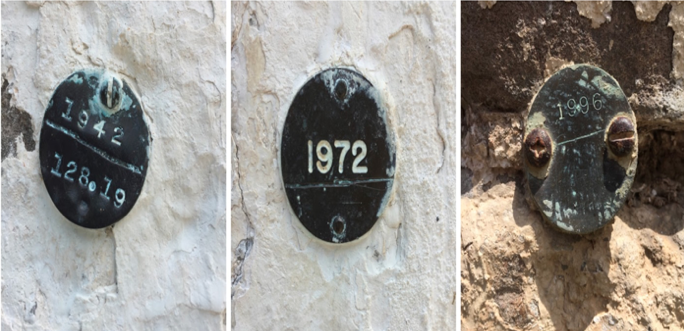
Becky Curtis, Director of Programs and Partnerships with the C&O Canal Trust, shared that a full flood plan will be designed for Swains Lockhouse with specific actions for each river level crest. Much of the plan will be based on Swain family knowledge of past floods, such as the flooding they experienced due to Hurricane Agnes in 1972, and how they protected their house. The flood plan will include actions such as moving furniture to the upper level, sandbagging around the Lockhouse, and turning off electricity.
C&O Canal Flood Control Plan
The National Park Service has its own flood control plan for preserving infrastructure and assets and ensuring visitor safety. This plan includes actions such as opening locks, altering water flow direction, and removing handrails to prevent demolition from debris. The C&O Canal provides critical flood protection for Washington, D.C., especially Georgetown. After the flood, wildlife relocation is provided for displaced and distressed animals—usually fish– and flood actions like sandbagging are removed.
Providing Future Protection
The rehabilitation work at Swains Lockhouse is guided not only by the need to preserve and restore the past but also to protect it for the future. You can support our work by making a donation to the Swains Lockhouse rehabilitation project here.
Author Christine Rai is a college professor in the Washington, D.C. area with a passion for culture, food studies, and experiential learning. She blogs about food, travel, and teaching at www.christinerai.com.